I’ve been trying to pick up vector mapmaking, since the raster image editing situation on Linux is so dire — so here’s something.
I’ve been trying to pick up vector mapmaking, since the raster image editing situation on Linux is so dire — so here’s something.
This post relies on some spiffy new browser features, and might not work on your machine. Apologies.
The Sledgehammer projection — named after the Peter Gabriel song — is a novel equal-area map projection designed to fill the same niche as the Winkel Tripel. A composite of the Hammer and Peters projections, it preserves area, gives both parallels and meridians pleasing curves, and with its pointed poles, it does not distort areas in far northern latitudes to the extent that flat-topped projections such as Equal Earth do. (I dare even say that it handles Antarctica alright.)
The exact formula, based on Strebe (2017)’s technique:1
To invert:
And, finally, an equation describing the outer boundary of the map:
An interactive version is available here. Happy mapping!

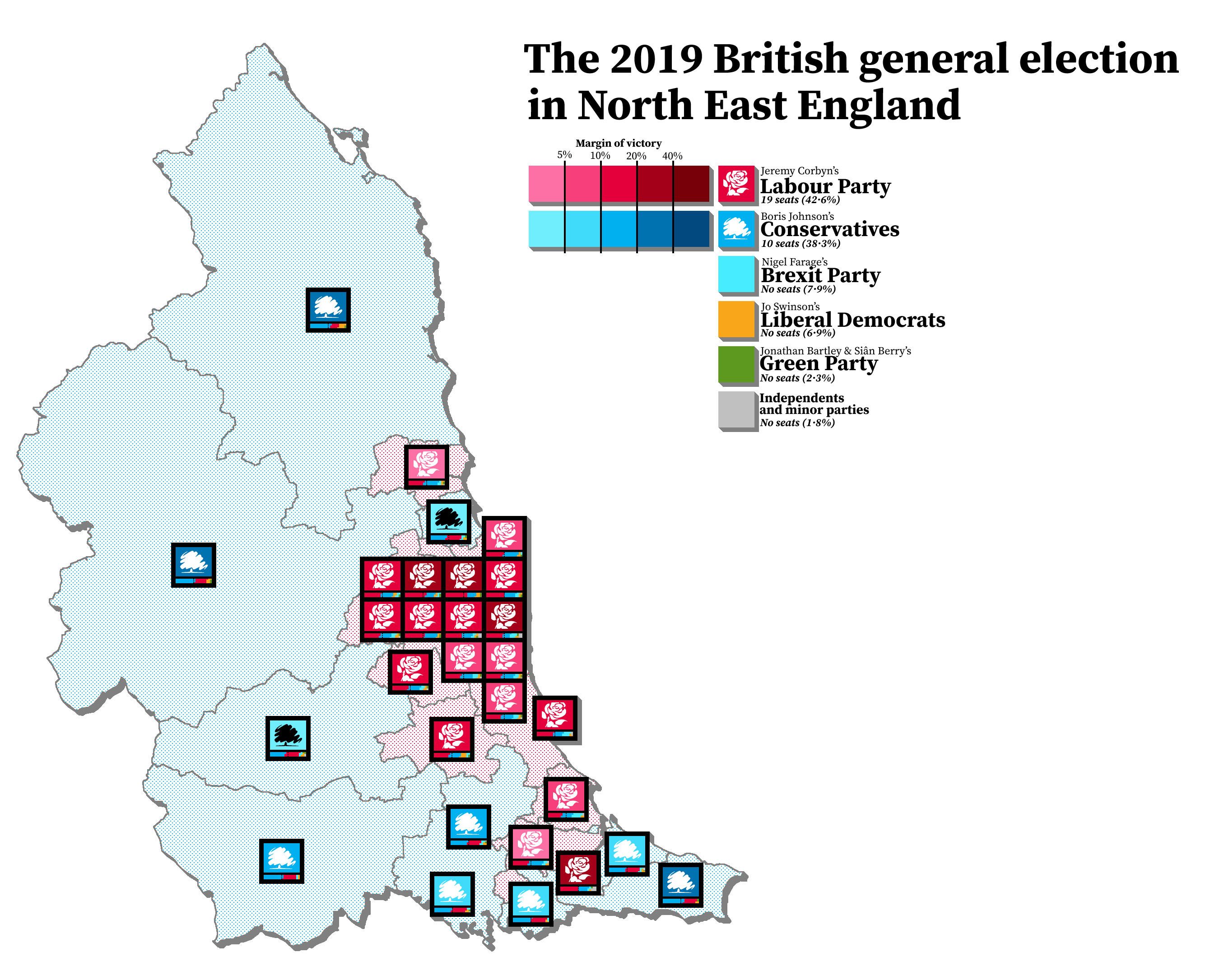
I’ve been terribly bored recently, and have been occupying myself by trying out a way i came up with of mapping out elections — a compromise of sorts between geographic maps (which don’t always show the whole picture) and cartograms (which tend to be butt-ugly).
I chose to map out 2019’s results in the North East to get a feel of things:
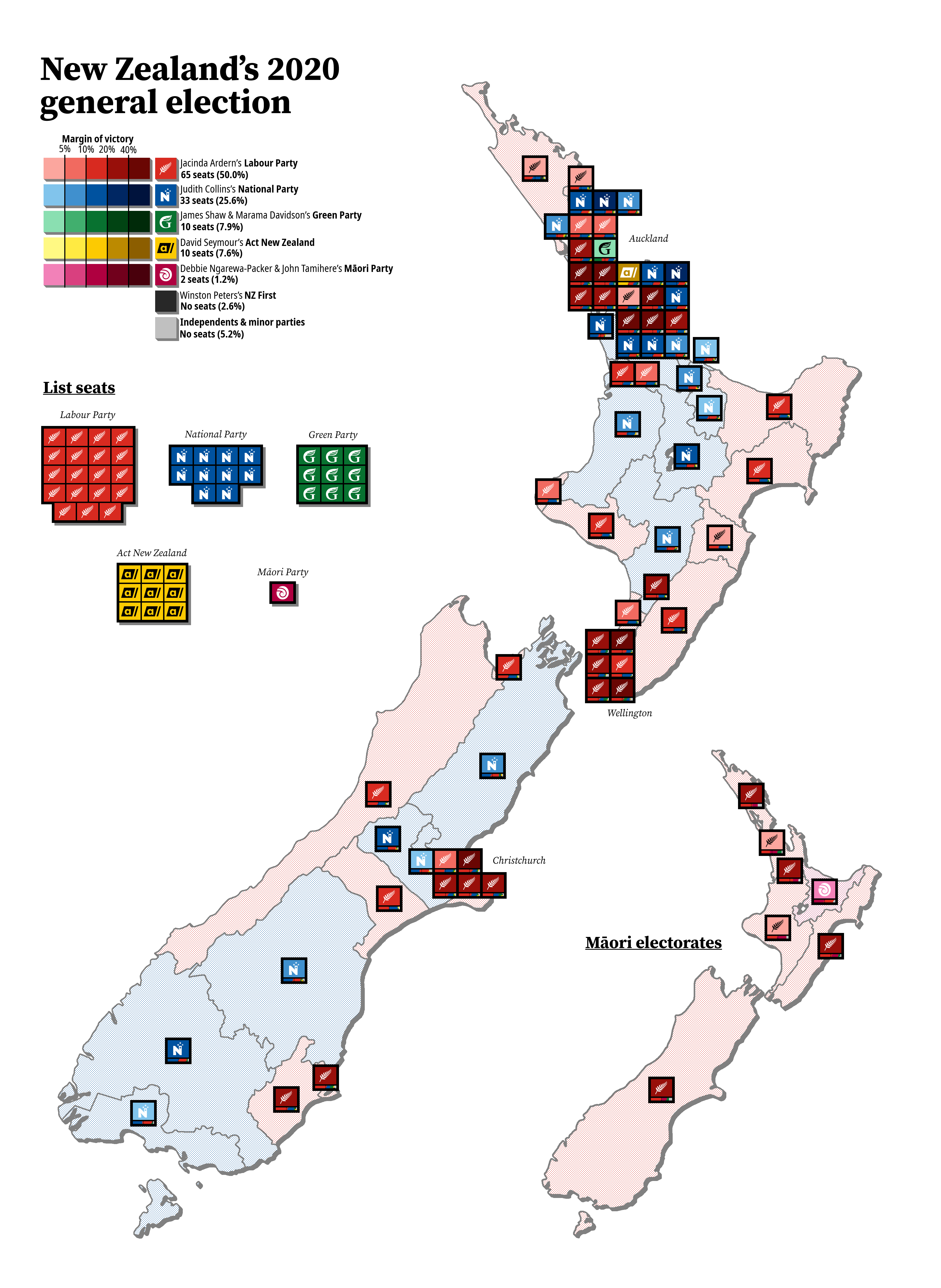
New Zealand is relatively small, so i figured it would be the best choice for the first full country:
And, finally, the most recent council election in good old Northumberland1:

I had that Mapmaking Itch, but, cursed by bike-shedding paralysis about the alternate history map idea i hadα, i decided to do a little doodle in the back of my journal instead…
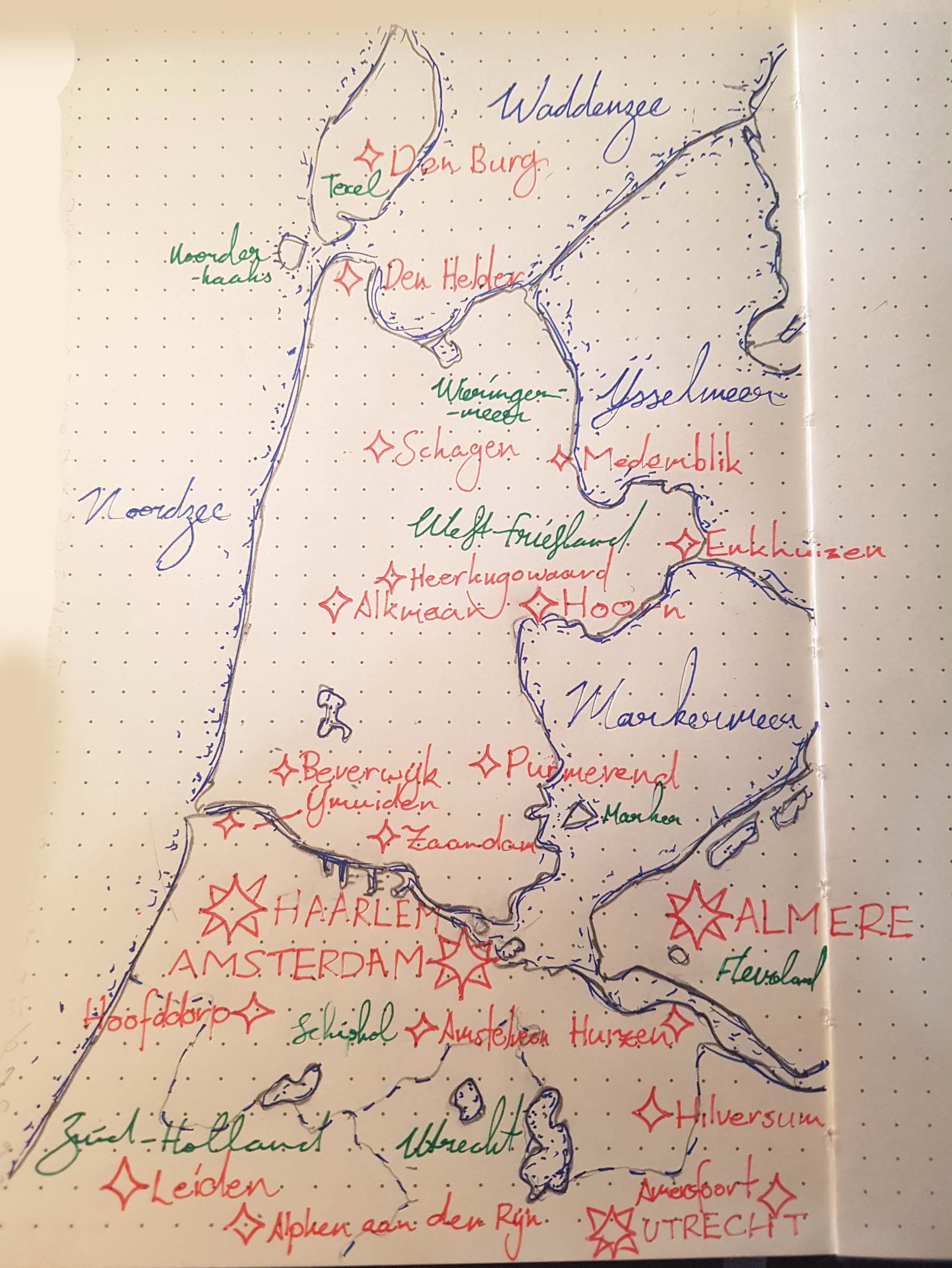
Don’t mind the chicken scratch. I would have done some nice coloured shading, but i couldn’t be bothered to go downstairs to fetch the coloured pencils.