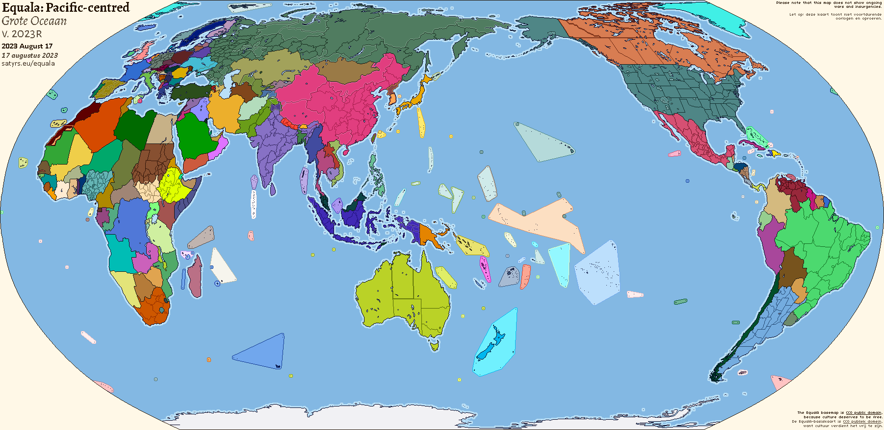
EqualAThe last basemap you’ll ever need
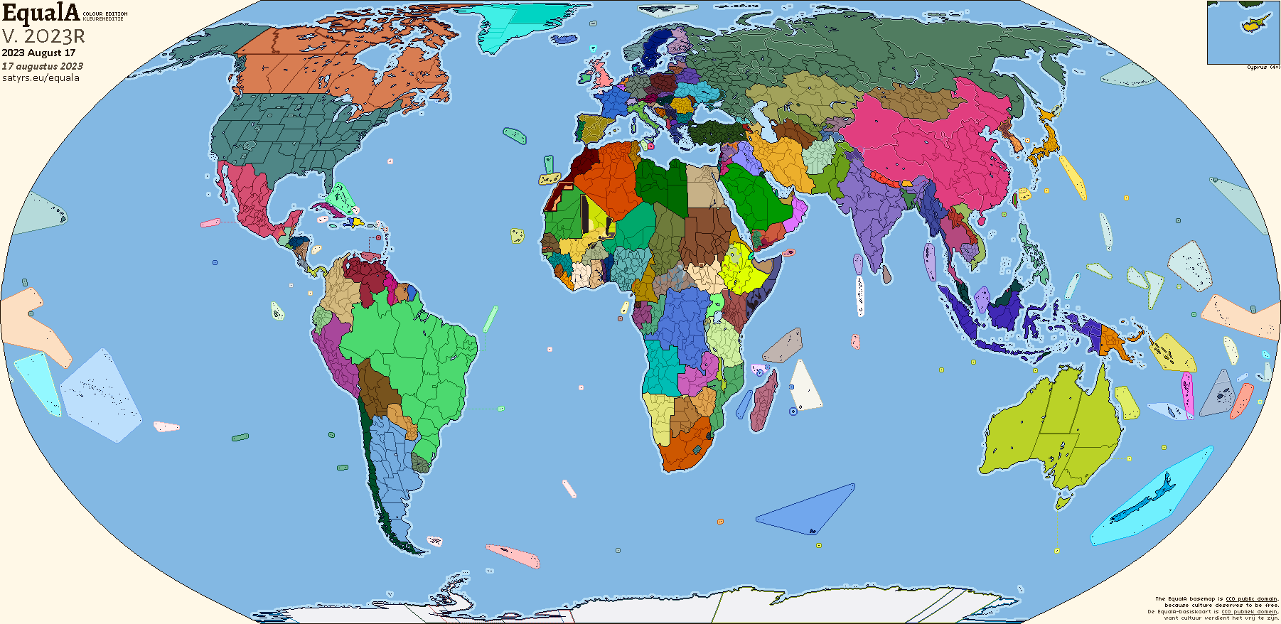
The EqualA is the last raster basemap you’ll ever need. A compromise between the too-small WorldA and too-big Qbam, the EqualA’s size is just right. The Florence meridian means nothing gets cut in half. And its consistent Equal Earth projection, accurately representing the size of every country, means all you have to do is drop your data into Qgis and reproject — no more faffing around with inconsistent transforms.
Use it for data. Use it for world history. Use it for alternate history and for whatever creative ideas take your fancy. With a CC0 public domain declaration, you can use it for all that and more to your heart’s content.
Changelog
-
2023R (2023 Aug. 17):
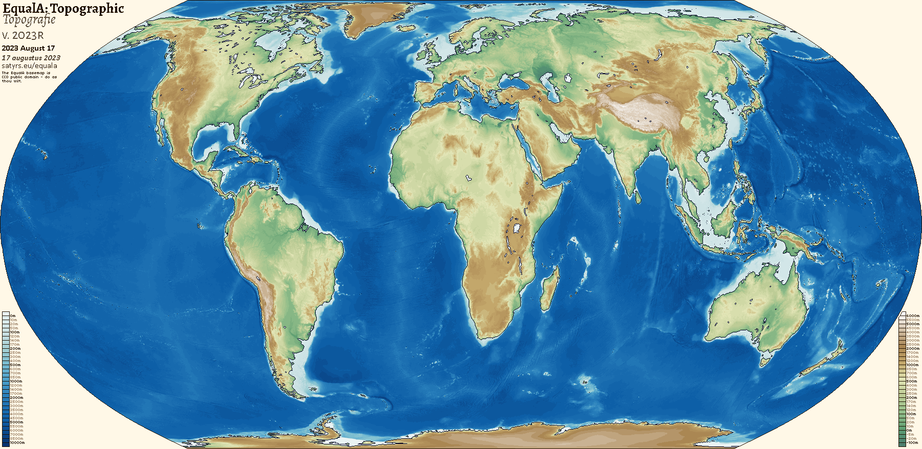
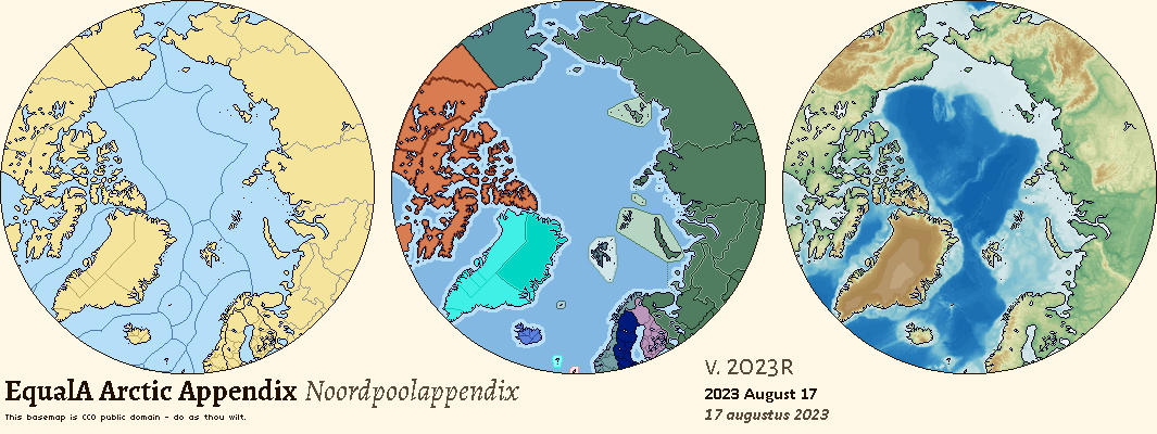
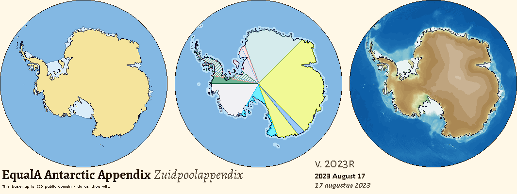
- Added a topographic map, as well as Arctic and Antarctic appendices
- Removed Ukraine’s Kakhovka reservoir, destroyed in the war
- Split Micronesia into its constituent parts on the colour map
- Updated wars in Mali and Ethiopia
- Scrapped a stray maritime border in the Persian Gulf that had been haunting the “Virgin Earth” map for quite some time
-
2023C3 (2023 Mar. 31):
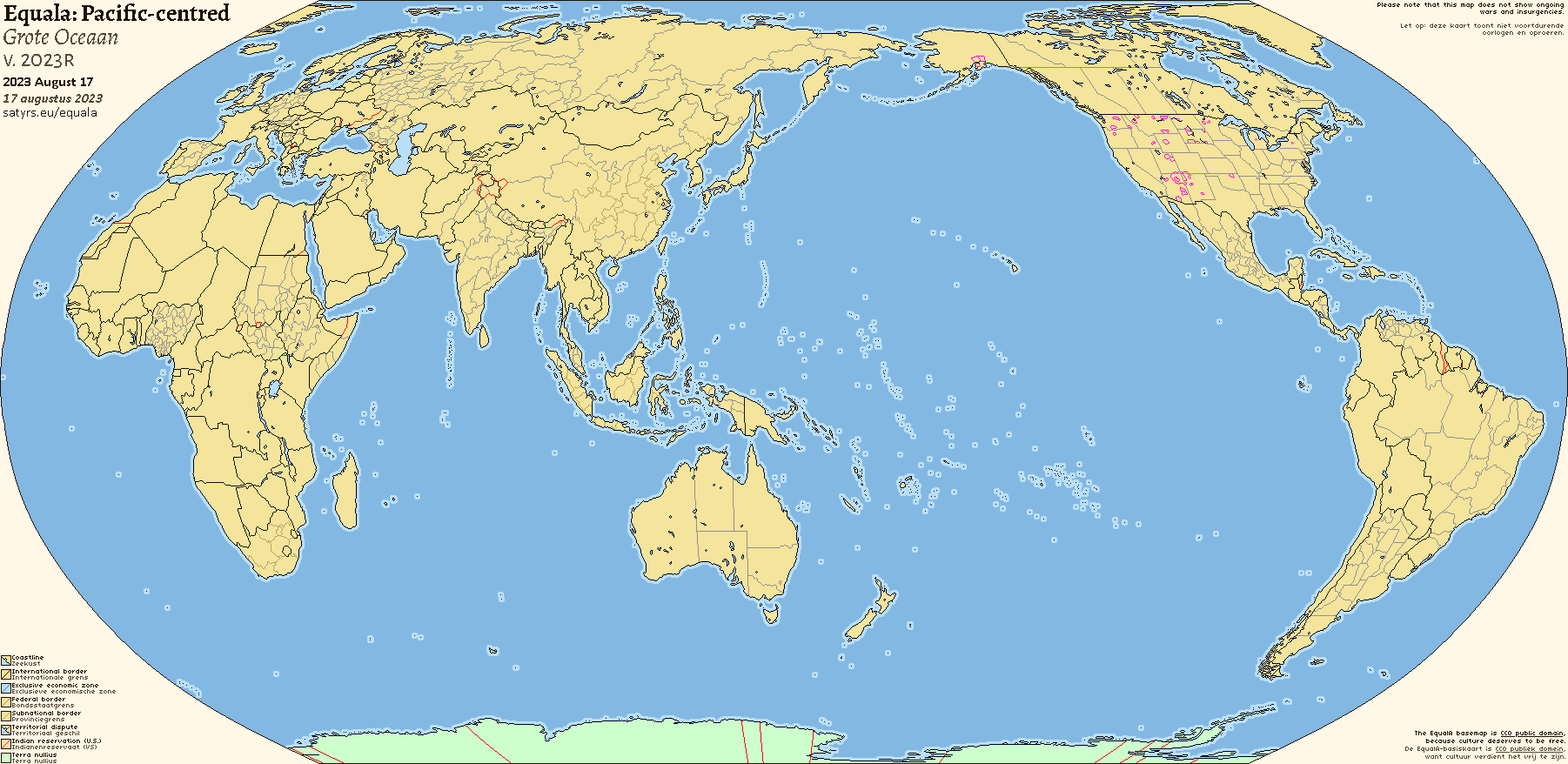
- Added two Pacific-centred maps
- Fixed various pixel-scale errors
- Added the Humber
- Updated state borders in Sudan and Indonesia
- Internal territories with less autonomy now have lighter borders, to distinguish them from regular colonies
- Fixed mistake where Macquarie Island was labelled as part of New Zealand, rather than Australia
-
2023C2 (2023 Mar. 11):
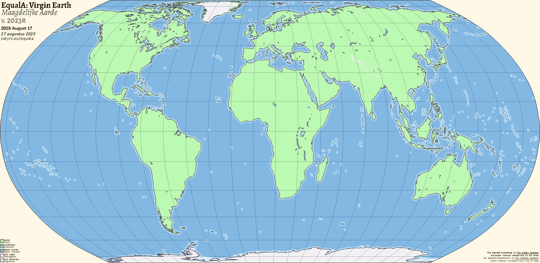
- Added a “Virgin Earth” map.
-
2023C (2023 Mar. 03):
- Corrected stray pixels in Mexico, Libya, and on the map border near Alaska.
- Updated regional borders in Algeria and Mali.
- Shrunk Lake Geneva to be truer to actual size.
- Added claims in Antarctica to the colour map, and fixed the borders on the main map.
- Removed indigenous-controlled areas in Canada; so far as i can tell, they function more akin to subdivisions of the provinces than the weird not-federal-not-state-but-a-secret-third-thing thing the U.S.’ reservations have going on.
- Removed Spain’s provinces, for similar reasons.
- Fiddled around a bit with water colours.
-
2023B (2023 Feb. 12):
- Finally gave the EqualA a definitive home on this site. Changelog doesn’t go any further back than this, because i’m a lazy bastard. :-)
More maps
Very Nice! What color pallete did you use?
The colour scheme is my own work-in-progress fourth version of the venerable Toaster — keep your eyes peeled!
Do you plan on making a topographic map and river map?
Is there going to be a second-level subdivisions addition to this? If so, I'd love to hear all about it. Also, what do you mean by 'drop your data into Qgis'?
@58 A topographic map is in the pipeline! I’m faffing about with colour choices for the time being, but it should be up when the self-hosted version of my site gets finished.
@61 I doubt it; the map’s quite cramped as is, and i don’t think i could fit, say, the U.S.’ counties on there without completely overloading it. By “drop your data into Qgis” i mean that you can just put a shapefile into Qgis (or use its reprojection tool) and project it into Equal Earth, rather than faffing around with warping and stretching onto more projectionally-inconsistent basemaps like the WorldA and Qbam.
Are you planning on making a pacific-centered virgin earth?
Just wondering, what would the size of a pixel of the map be compared to the real-world Earth?
Will you release a topographic Pacific-Centered Map?
@189 @200 I’ll be honest and say any new maps are mostly conditional on someone making a better image editor for Linux — using Gimp for these is like pulling teeth, so i’m not liable to do it to make an entirely new map if i don’t have to.
Maybe you could try Photopea? It works a lot like Photoshop which I've used a lot for map making.