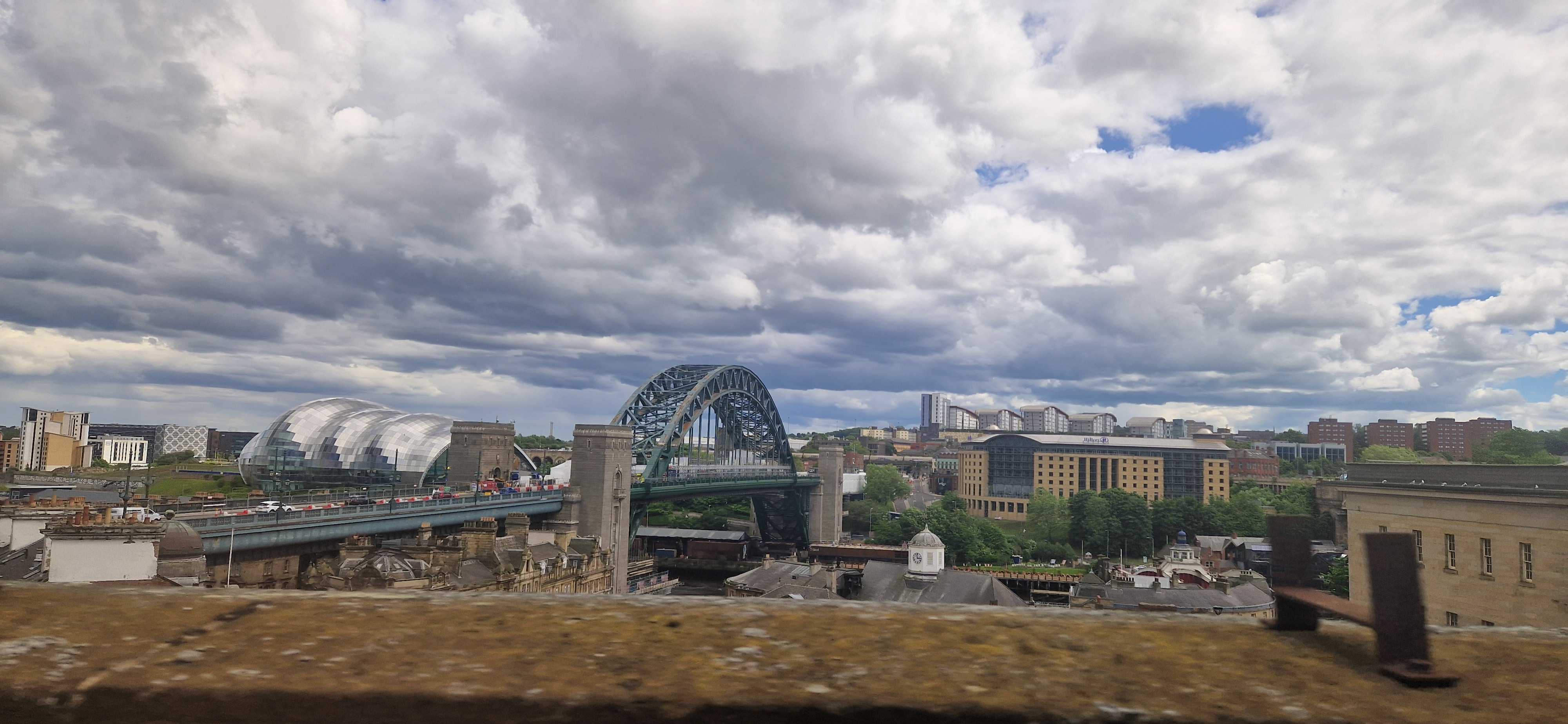
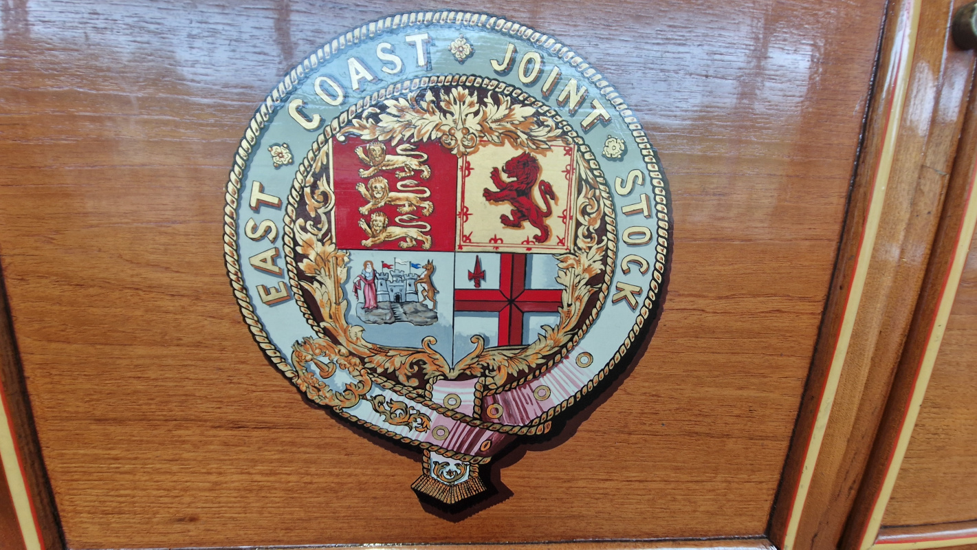
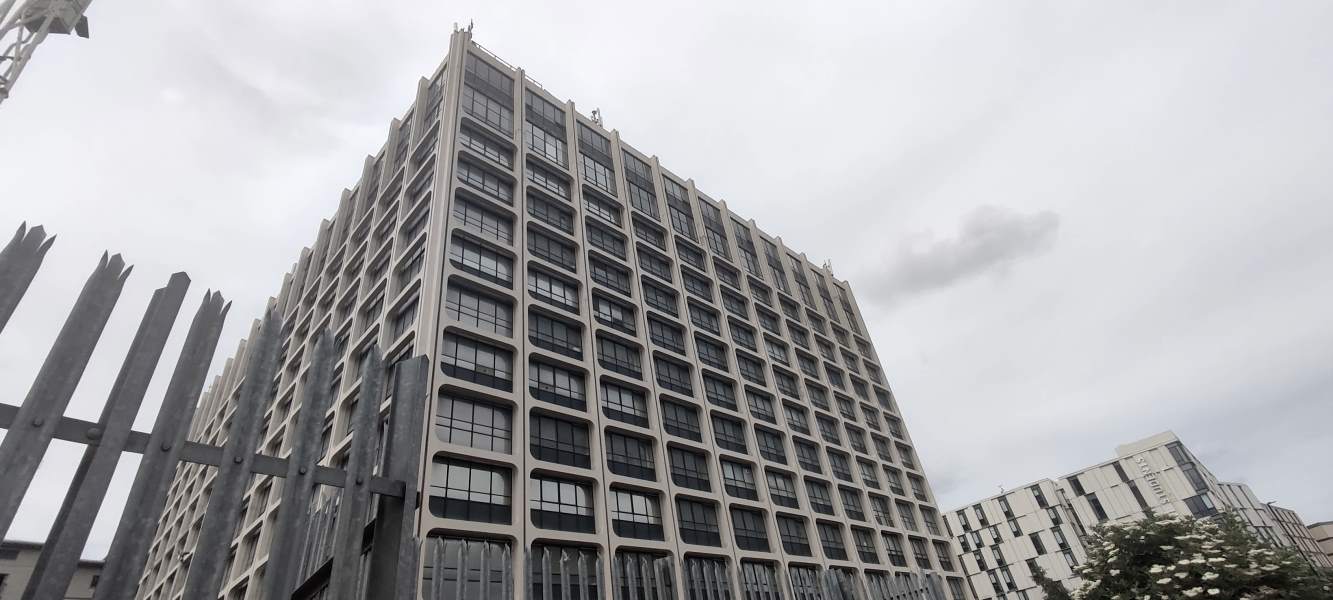
The Tyne and Wear Metro is a marvel of the British railway network: the only true metro system outside of London and Glasgow1, with fully accessible stations, beautiful typographic design, and only the occasional closure because someone stole all the copper wiring again. But amongst railway nerds, it is also known for one more puzzling detail: it’s a pretzel.
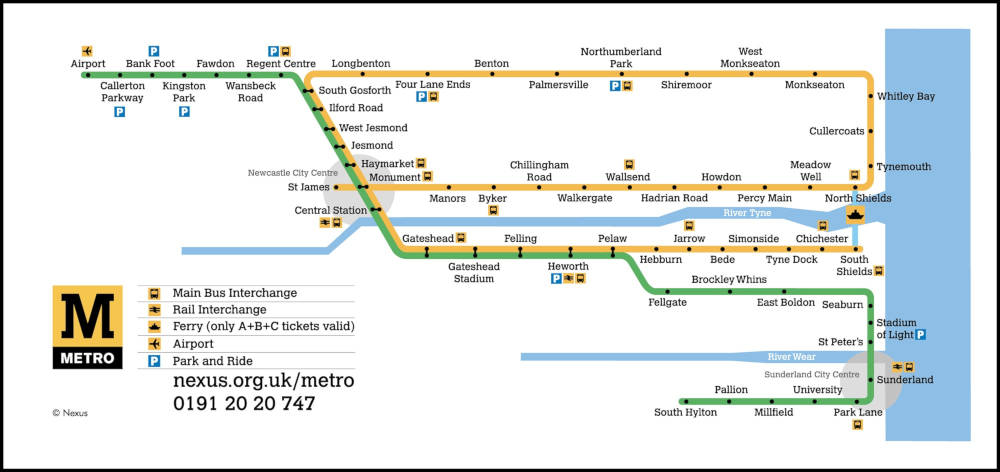
That’s right: you can, if you want, catch a Yellow Line train at Monument, go all the way around the coast, wind up right back where you started, and continue all the way down to South Shields just to rub it in. Put otherwise: there are four platforms and they’re all for the same line.
This is, as far as i know, unique to Newcastle. Bucharest almost gets there, but chickens out just before the line actually crosses over. Sofia nearly pulls it off but, in a shocking display of cowardice, redesignates its Line 4 as “Line 2” halfway through the loop, disqualifying them immediately. The Hague does something even more complicated, but it’s on a tramway and i can’t in good faith count it. And Vancouver used to have the same setup — even using the same colour — but switched to a perhaps more sensible timetabling in 2016 when an extension rendered it unworkable.
So… why? What’s the point? Let’s find out.
As is often the case with urban rail, the constituent parts of the Tyne and Wear Metro were built at different times by different, competing companies, and were only later stitched together into a coherent network.
The first part of the loop to come online was the Newcastle and North Shields Railway, starting in 1839, who ran a service from the centre of town to (where else?) North Shields, later extended a teensy bit further to Tynemouth. The N&NSR’s mighty viaducts still carry our dinky yellow trains over the Ouseburn to this day.
Meanwhile, further north, coal mining in Northumberland was growing rapidly. (This brought great prosperity to the region, which would surely never ever end. Ever. Unless they closed the mines, but come on, why would that ever happen?) The existing main-lines found themselves choked by the influx of traffic, and in 1852, Parliament authorised the incorporation of the newfangled Blyth and Tyne Railway.
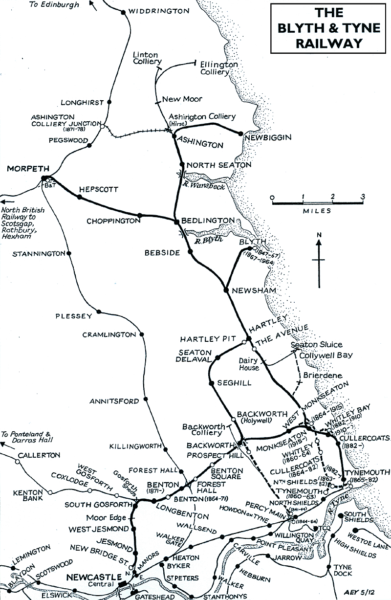
The B&T at first linked Bedlington and Blyth only to the staiths at Percy Main, but by the eighteen-sixties it had added branches to the centre of town — encouraging buildup in Newcastle’s northern suburbs — and to the growing seaside holiday destination of… Tynemouth.
Hm.
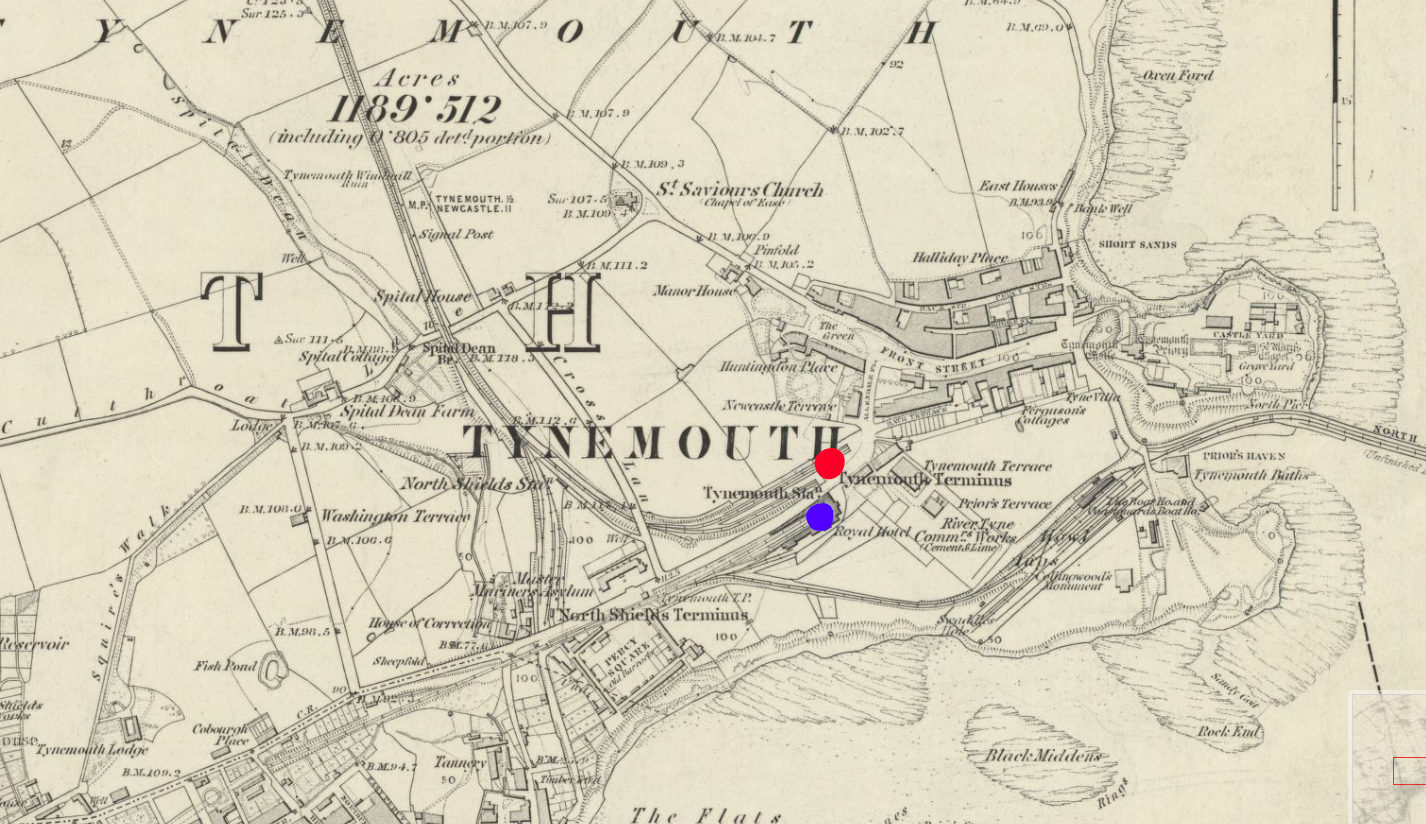
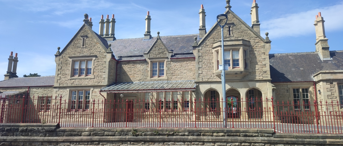
By the early eighteen-eighties, both the B&T and the N&NSR had been absorbed into the North Eastern Railway, which found itself in the awkward position of having two formerly competing stations right next to each other and no way for trains to transfer between the two. So, in 1882, the two competitors’ lines were linked up with a new alignment running closer to the coast, including the opening of a gorgeous palatial through station at Tynemouth, still in use by Metro trains and Sunday markets to this day.
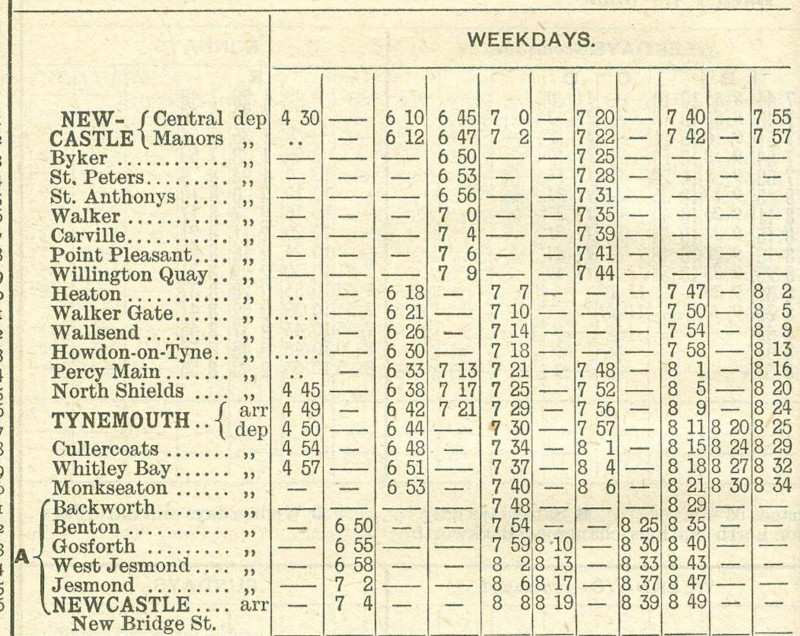
The earliest timetable i could find, from 1902, shows that trains were indeed running in a loop around the coast, from the city centre to Wallsend to Tynemouth and back, just as is possible today.
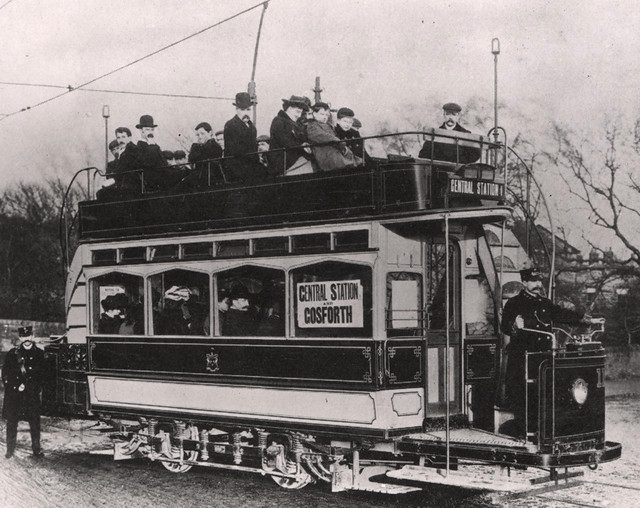
At the dawn of the twentieth century, however, the steam services were threatened by a rising competitor: the tram. No longer did you have to put up with noisy, steam-belching locomotives every day — you could get to exactly where you wanted to go, in style! This, of course, wouldn’t do, and so the NER embarked on a rapid programme of electrification. By 1904, the loop had fully switched over, and the network was rechristened the ✨️ Tyneside Electrics! ✨️
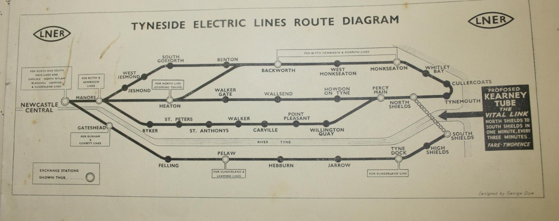
By this point, the network clearly resembled what we have today. Now, it didn’t quite loop over itself like today — everything went through Central Station; no perpendicular Monument tomfoolery here — and there was an extra branch snaking along the riverside which was never refurbished for the Metro era. But other than that, the geometry was pretty well set, and there would be no major service changes until the introduction of — what do you mean, you want to know what the big black arrow’s for?
Whenever i show a diagram of the Metro to my non-Geordie friends, the first response is usually something to the effect of, “Why isn’t there a link between North and South Shields?” It’s a fair question, and the canned answer i usually give is that building one would be a lot of expense for little point, since there’s already a well-trafficked, well-loved ferry service between the two. Little did i know that it could well have been otherwise.
Elfric Wells Chalmers Kearney was an eccentric Australian engineer who spent much of his life trying and failing to convince city governments to adopt his all-new danglebahn, the Kearney High-speed Tube™. Here he is in 1910 with a model he made earlier:
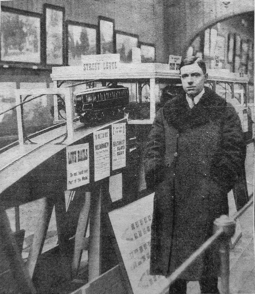
The “Kearney Tube”, as it was known, would be powered by the force of gravity, hurtling down a ⅐ gradient from stations just below the surface like a bizarro funicular before climbing gracefully back up, suspended between a monorail below and a guide rail above, which would (in theory) stabilise the train’s side-to-side motion so as to not induce vomiting in everyone who rode it.
Mr Kearney promoted his invention in cities as distant as Sydney, London, Portsmouth, and (if secondary sources are to be believed) Venice and New York, but it came closest to reality between North and South Shields.
Over sixteen thousand Tynemouthicans signed a petition calling for its construction, and in 1925 the government gave a provisional order approving its construction. Alas, when it came time for a parliamentary committee to give Mr Kearney’s dream the final go-ahead, they were rather more sceptical. He had raised nowhere near enough money to actually build the blasted thing, and the members were quite concerned about the impact it might have on the livelihood of the Tyne’s ferrymen.2
Mr Kearney held a grudge for the rest of his life. He made elaborate, typewritten conspiracy diagrams indicating who was paying off who, and gleefully wrote of the death of his opponents on the committee — or even those who were only tangentially connected:
Under pressure from Lord Ashfield, Henry Ford went back on his undertaking to finance the first Kearney Tube between North and South Shields. Not long afterwards Esdell Ford [sic], Henry Ford’s only son, was taken ill and died.
In 1939,
he gave it one more go, partnering with the LNER — only for the outbreak of the second world
war to put an abrupt halt to any civilian infrastructure plans. He would eventually write
a science-fiction novel titled
Erōne, where his his protagonist’s ideas are proven correct by a utopian society on
Uranus, and if only the good people of Earth would listen!
Mr Kearney died in 1966, never having seen his utopia come to fruition. I was unable to find where or how, or even in which continent he is buried — he split his time between Australia and Britain, and he could plausibly have passed on either side of the equator. Still, i hope he’s up there somewhere, smiling down on all the shweebs, hyperloops, monorails, and other gadgetbahns of today.3
By the nineteen-sixties, the Tyneside Electrics had seen better days. Passenger numbers were falling, the trains of tomorrow were decrepit, and they weren’t even electric — British Rail had deemed it more cost-effective to run slower, dirtier diesel trains. The system had become a kittiwake4 around the North East’s neck. So, in 1971, the local transport executive commissioned a study — and they came back with a plan.
You know how the rest goes. Though the Tyne and Wear Metro would mostly reuse the existing routes mentioned before, they would all be linked up through a newly constructed central core underground — meeting in the middle at Grey’s Monument.
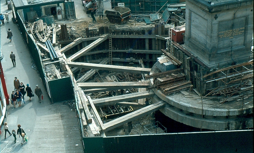
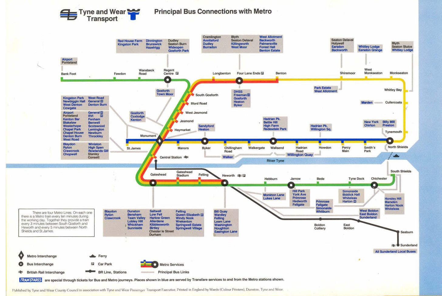
The pretzel shape was completed by proceeding one stop further from Monument to stubby St James’ Park.5 This was just a temporary terminus, of course — the station was built so that, in future, they could easily come back and extend it out to the long-underserved west end of the city. Quoth 1981’s “Tyne and Wear Metro: concept, organization, and operation”:
St James station is at the centre of an area designated for future office development and also serves the football ground; the station has also been designed to allow the system to be extended westwards at some future date.
So, eventually, that happened, right? They turned that little stumpy arm into a full-fledged extension. Right? …Right?
In 1981, environment secretary Michael Heseltine vetoed any further extensions to the Metro system. Since then, the only substantive changes have been in 1991 — inking the airport to the rest of Newcastle — and 2002, when, after twenty years, the Tyne and Wear Metro finally reached Wearside. It is around 2002 that things get a little silly.
Shortly after service to Sunderland began, Nexus (the local transport operator) announced Project Orpheus, their grandiose plan to build a transport network fit for the twenty-first century. Bus rapid transit for everyone! A cable car in Gateshead! And, yes, the valiant return of trams to Newcastle-upon-Tyne, connecting the west end up with the city centre.
None of this happened. The plans were watered down and watered down until all that was left was the vague idea of refurbishing the Metro and making buses more frequent. The great recession and austerity presumably killed any hope it had left. You still get calls from local councillors to extend the system to their part of the area, but they seem unlikely to amount to much. So is all hope lost?
Well… remember the Blyth and Tyne Railway?
Passenger services along the B&T north of Backworth were given the chop by Dr Beeching in the nineteen-sixties. Combined with the end of coal, this was a one-two punch in the gut for working-class mining towns like Ashington and Blyth, leaving them some of the most impoverished in the country.
Local campaigners have been calling for its reopening since the nineties, initially to little avail barring a token mention in the ill-fated Project Orpheus plan. In 2013, Northumberland County Council started taking the idea seriously. In 2019, the transport secretary gave the thumbs up. In 2021, shovels hit the dirt. And in 2024, for the first time in half a century, trains carried passengers from Ashington to Newcastle.
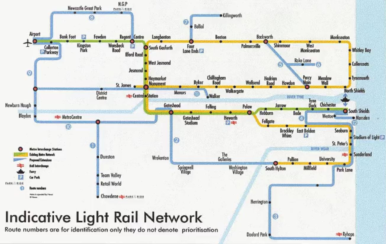
It may be like pulling teeth, and it may cost more than we might like, but Britain can still build things — and local politicians seem to have noticed! In 2024, work began on the first serious proposal since Orpheus to extend the Metro; this time, to Washington, along the disused Leamside line.
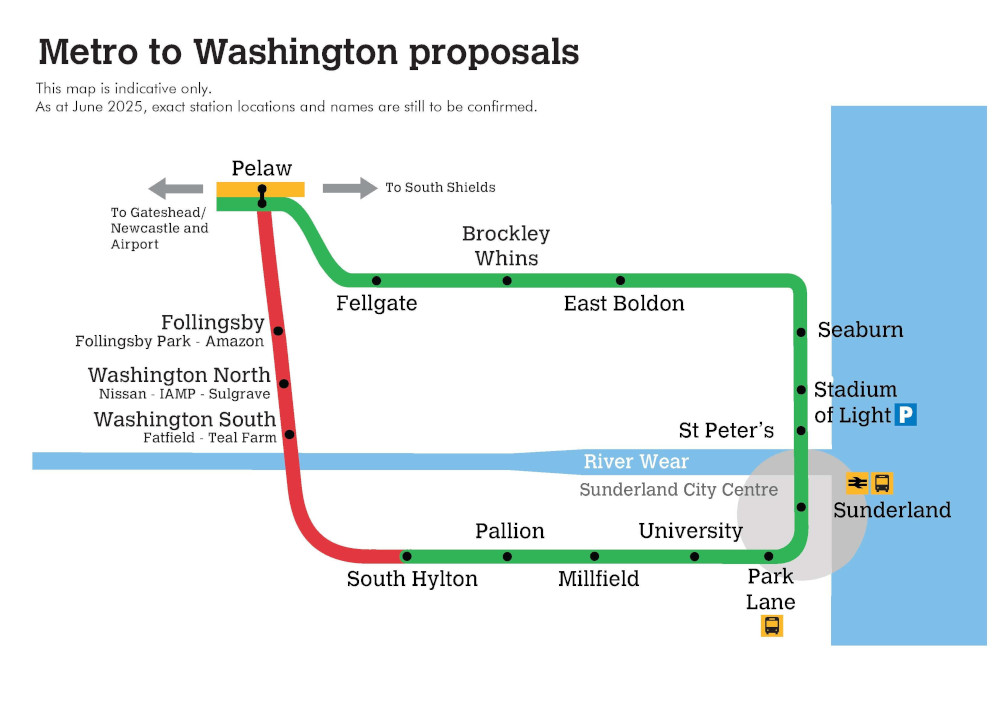
Curiously, the proposed extension goes in yet another loop. It’s hard to imagine this wouldn’t require some rejigging of how the network runs — a third line, perhaps? New platforms at Pelaw? But however they run it, it looks like, if it goes through — and that’s a big if — the Yellow Line may not be alone in its topological weirdness for long.
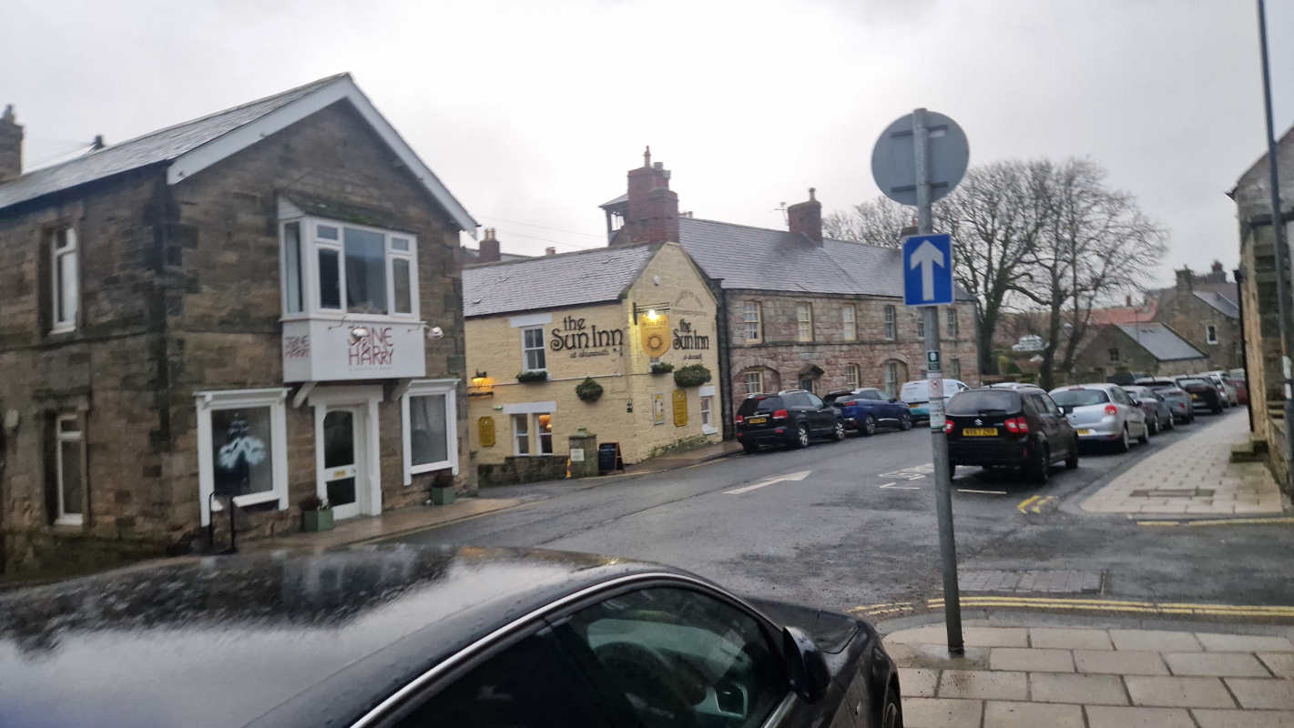
When i was a child, old enough to be firmly planted in the UK but young enough that every day outside a school’s walls was magical, my family would sometimes take the train up to visit kin in Scotland. I got the window seat, of course — i still hold that those who genuinely prefer aisle seats are suckers — and as i watched the Northumbrian countryside roll by, the sight of one particular town always held my attention, what seemed to me like some kind of Turneresque utopia by the sea. But we never debarked until Scotland was in sight, and this village thus remained a mystery to me. Some days ago, i decided to rectify that. Welcome to Alnmouth.
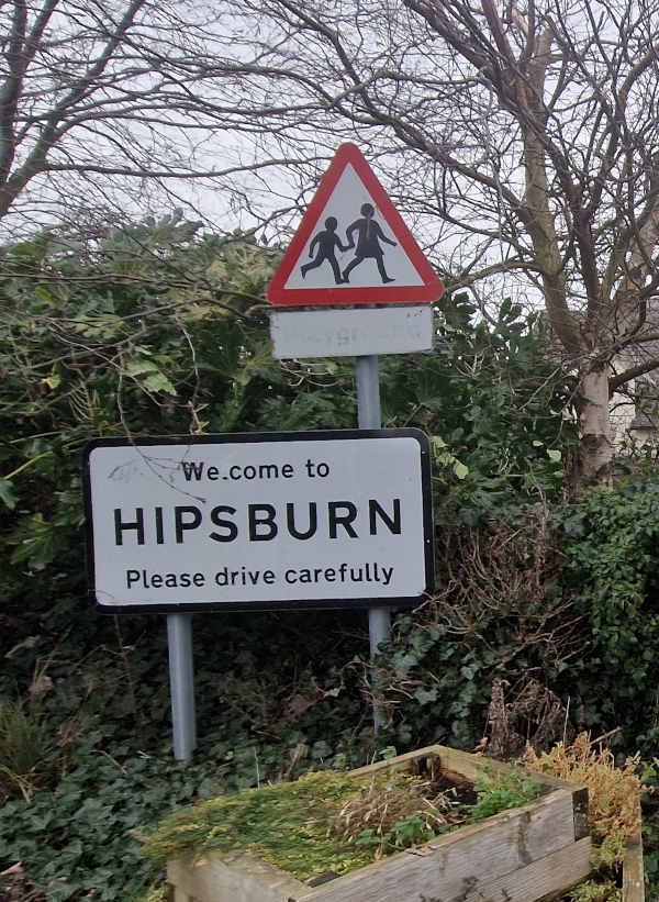
Well — i say Alnmouth, and indeed so does the sign at the railway station, a modest and drizzly affair that gets a surprising amount of service due to its prime position on the East Coast Main Line. One thing you must understand about the sign and i is that we are filthy, filthy liars. This is Hipsburn, a teeny-tiny1 village about a mile inland. You can get a bus from here to there, or, indeed, to Alnwick, the other town on the station sign and by far the more prestigious.2 But that would be boring, and i came here to touch grass, not listen to other people’s TikToks at maximum volume, so it’s off along the B1338 i go.
As i approach the roundabout ahead of me i think to myself that i would like to retire in one of these cottages, and maybe die there if my transhumanist sympathies should ever fail me. The village’s last institution before it peters out into the countryside is Alnmouth United FC, who are slumming it down on the ninth step of the football pyramid. I wish them well; my old hometown’s club recently folded and got locked out of their pitch, so it’s good to see the local game alive and well here.
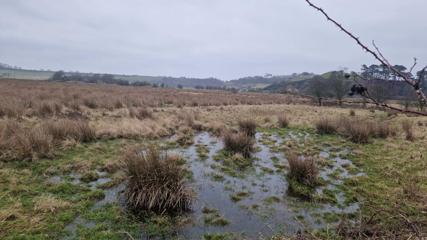
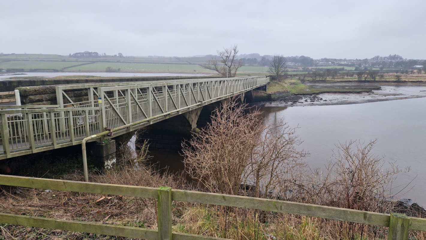
From here things get squelchy. I rest for a moment on the girdered pedestrian footbridge, which clings on for dear life to its Victorian car-carrying counterpart, and gaze inland over the river as it flows downstream and under my hooves. The marshy pastures all around, too salty for crops of human worth, once fed oxen and other beasts of burden, but, in 2006, their flood defences were deliberately breached, rewilding them and creating swathes of estuarine saltmarsh. I’m not holding my breath for otters to show up — they’re crepuscular buggers, and i’ve come in the afternoon — but i do spot a relaxed teal in the grasses. (I’ve always been more of a mammal fan, but it’ll do. Call it a home-team bias.)
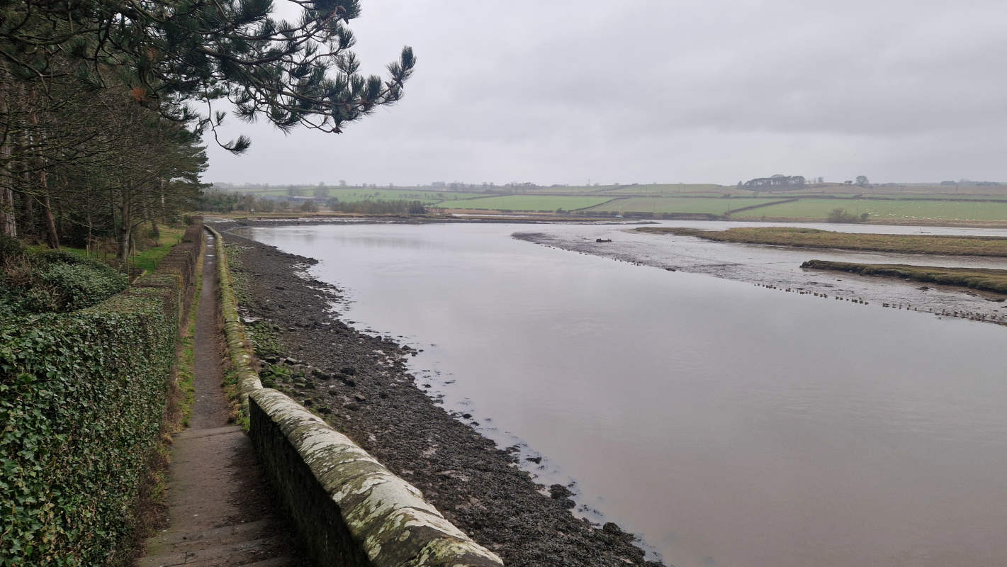
I carry on down the “Lovers’ Walk” (a popular term for scenic walkways in the eighteenth century, a sign assures me), wedged between piny hillside and sandy water. This is perhaps not the scenery that England would like to advertise to the world: a cold, grey, winter day, where the nominal path is liquid with mud and the river seems permanently half full. Nonetheless, this part of Northumberland is one of our “National Landscapes” — né·e Areas of National Beauty — and i find it sublime even in the most miserable weather.
As i edge closer to the town, a chorus of tweeting, chirruping birds grows louder and louder. I attribute it to the flock of wigeons across the river, but, passing by the boating club and getting (relatively) further inland, its loudness refuses to fade. Imagine my surprise when it turns out to be the back garden of a holiday cottage!
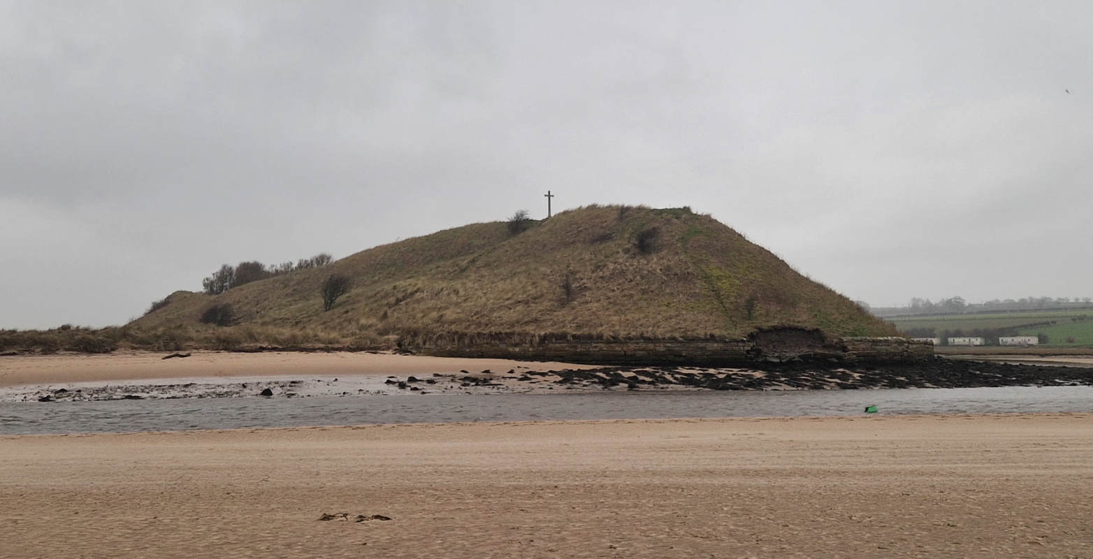
Back down to shore and through the dunes, now. “Danger: River estuary. No bathing,” complains a sign from the council, which is a shame, because unless i want to backtrack it’d be the only viable way to reach the landmark that dominates Alnmouth’s skyline (to the extent that it has one): Church Hill, a cross-topped hillock ever impending in the distance.3 It is said that it was on this wind-blasted top that, in 684 CE, Saint Cuthbert was elected to be Bishop of Hexham. It is also said that two otters would come and warm Saint Cuthbert’s feet after he had stood in the freezing North Sea and whispered his nightly prayers, and that animals regularly helped him with his housework, so take these things with a grain of salt.
At last, i make it to Alnmouth itself, and i regret that i have little to say about it other than that it is nice. There are many nice places in Northumberland, usually ones not located over a coalfield, and though i find them all pleasant, i confess i sometimes have a hard time telling them apart. I take a short break in a café whose windows, in this weather, make the outside world look like a still life by Mr Magoo. I savour every sip of their hot chocolate. It tastes like the ones grandma used to bring home from Spain. I would have liked to stay longer, but as it is, it will already be dark enough by the time i get back to Newcastle (let alone my actual hometown) that they will be holding candlelit vigils for the slain Iranian protestors by the Monument. So, as one does, i leave for the beach.
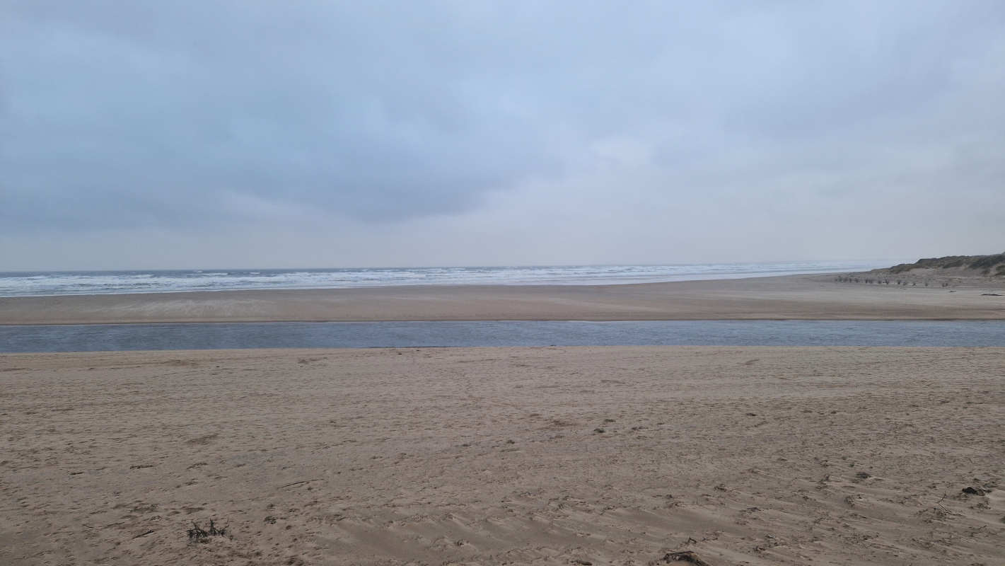
The walk over takes me across the manicured grass of the local golf club, who i’m again sure are very nice.4 I hang back from the frothy Atlantic, conscious that touching it will likely freeze my bollocks off5, and focus on the sand beneath my feet, its consistency akin to that of… well, sand. Specifically, it reminds me of the play sand that gets everywhere and which every parent surely regrets ever buying for their child. It is soft enough to sink in my steps, tough enough not to immediately fizzle and flood back into the hole left over. The Dutch call this taai, especially when it comes to the texture of food, and it has always bugged me that there is no decent English equivalent.
Trudging back to the Lovers’ Walk over the estuary flats, i spot something that mystifies me. Gossamer shifting sands, light as silk, sailing and shimmering with the force of the wind. When i go over to stand amidst them, they are so thin that i feel nothing on my ankles but the wind. I imagine myself as a sort of low-rent Lawrence of Arabia.
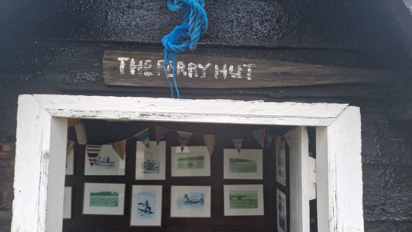
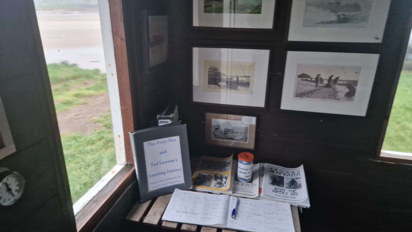
The last place i take note of is a small hut on the land of the boating club. I saw it on the way in, but thought nothing of it at the time, figuring it served some private purpose. But… it’s awfully empty, and there’s noöne around, so… it can’t hurt, can it? I venture towards its nigh-black planks. Crude painted lettering on an old oar over the door calls it the ferry hut; inside, this old shack has been converted into a miniature museum of the village’s history — its people, its ferrymen, how it fared in the war, all told through laminated books and picture frames. I wish i lived in a town that had as much respect for itself as this mere village of five hundred!
Not having brought enough cash for a substantial donation, i settle for a slightly guilty signature in the exhibition’s guestbook, and carry on my merry way home, pleased as punch. I think to myself: I’ll have to come back.
I’ve done some fairly interesting things this month, and had planned to write posts for each of them — but, for whatever reason, none of them provided that particular spark to me. Maybe they just didn’t seem that interesting to explain to you, the reader, or maybe i didn’t know what to say about them except the obvious.
Nonetheless, it would be a shame for these events to pass into the annals of my journal without telling you about them. So! Here’s a brief summary of my unblogged July thus far.
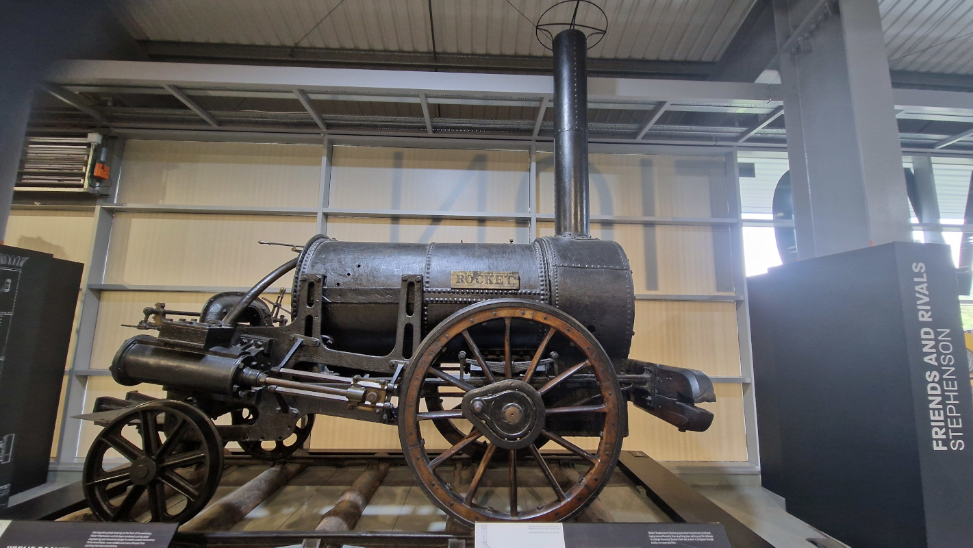
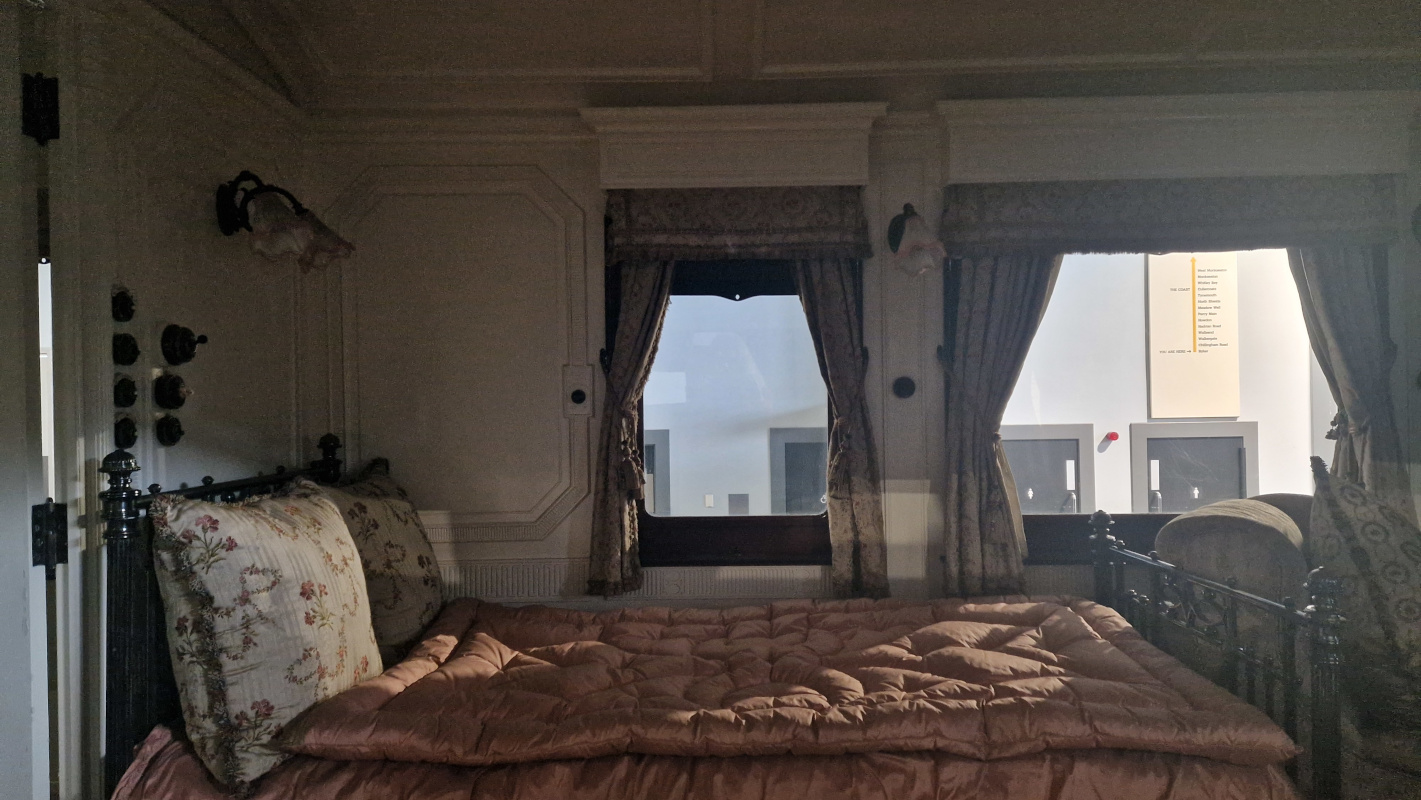
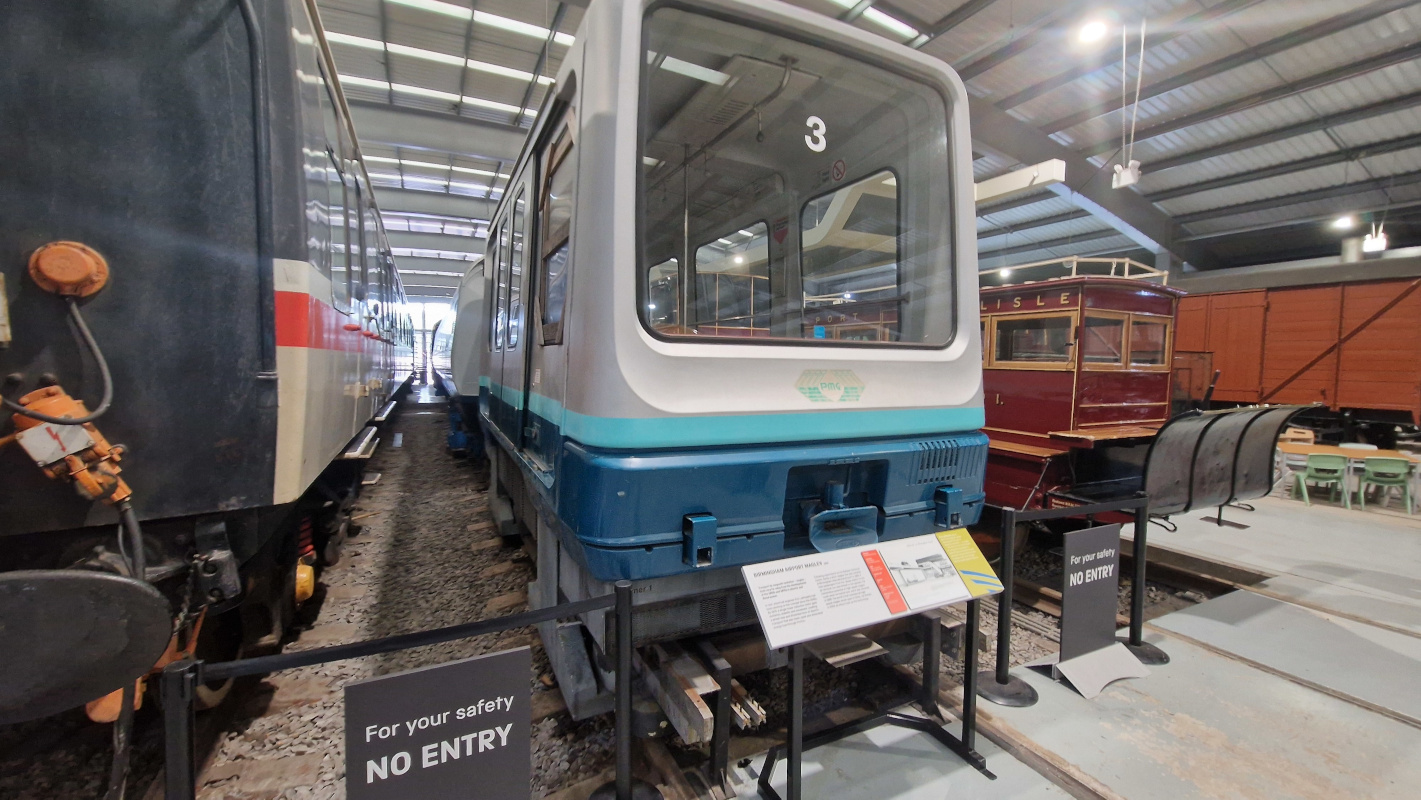
I toddled off to Shildon to visit Locomotion, the local branch of the national railway museum. It’s the birthday of the railways, and thus boasts a disproportionate selection of anorak arcana — alas, you can’t go in the trains, but you get a pretty good look at the inside of Queen Alexandra’s royal train car, the erstwhile Birmingham maglev, and, most proudly, Stephenson’s Rocket.
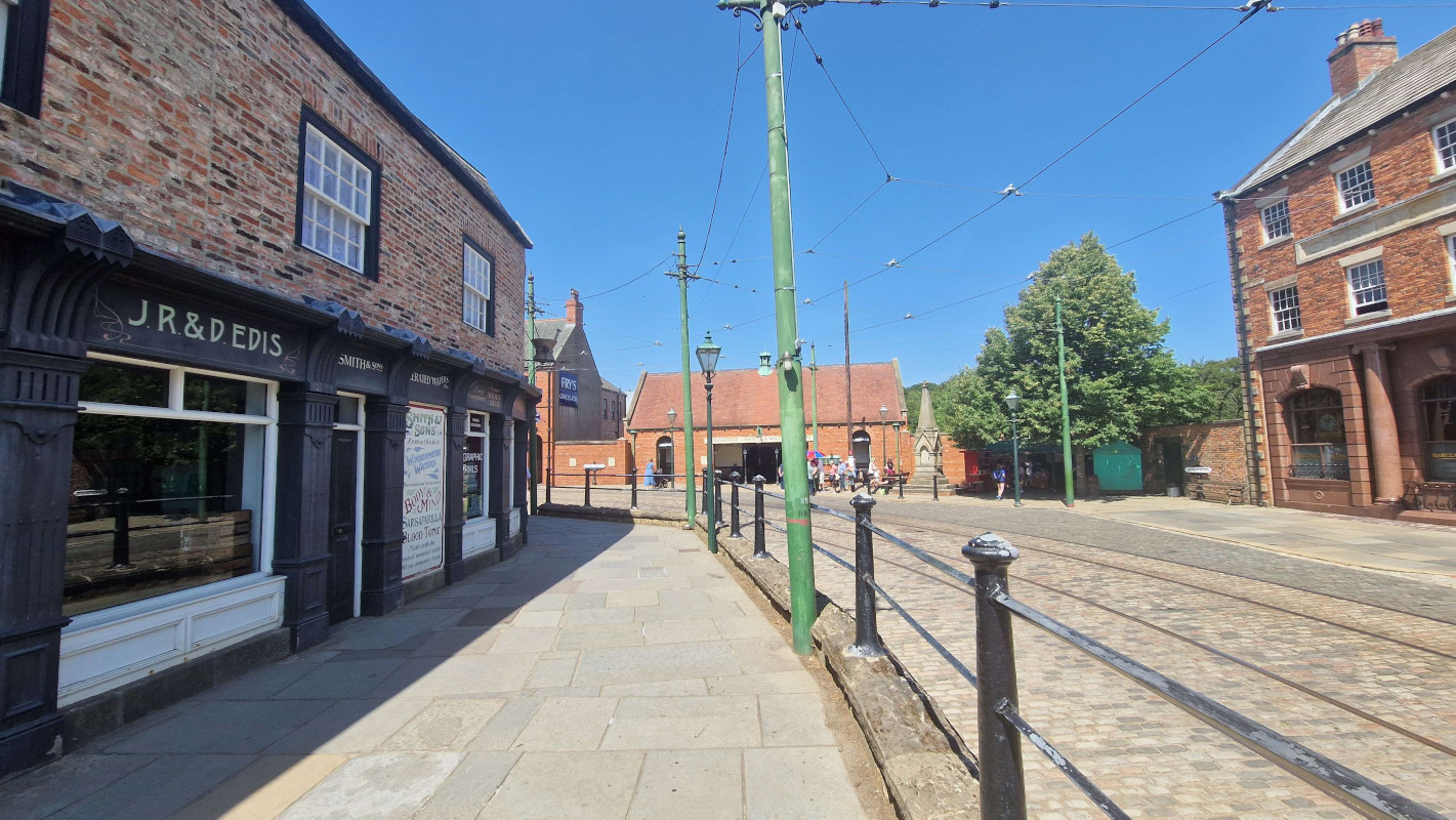
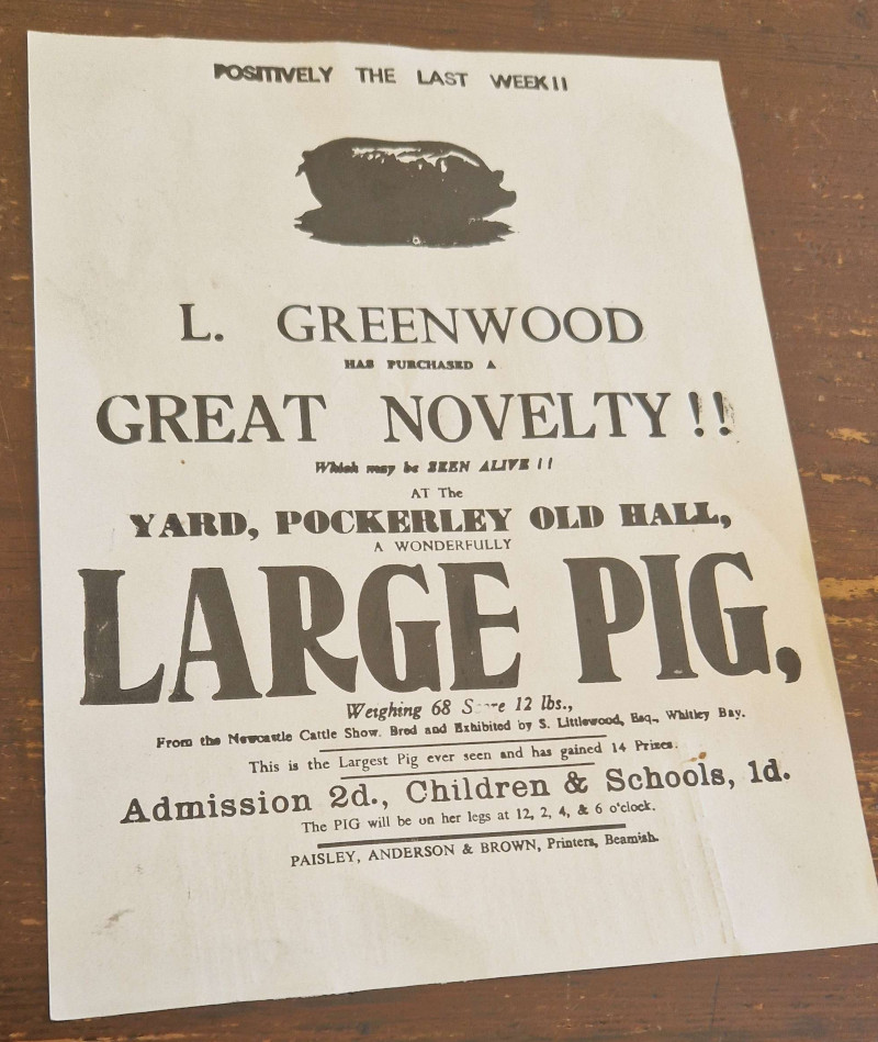
Beamish1 has been newly crowned Museum of the Year, so there was no better time to check it out. I hadn’t properly explored their new fifties town yet — the chippie and the old houses are wonderful, but the record store, crammed up the stairs, across an anachronistically modern mezzanine, and down a grey corridor, leaves much to be desired. Nitpicks about balcony design aside, it’s as great as ever, and, somehow, well worth the £33(!!!!!) asking price.
Finally, just yesterday, i went off to an Elbow concert hosted in a ruined mediæval priory by the sea. Belting out “One Day Like This” in the fading dusk light with five thousand other people standing on the same hallowed ground where monks tried to figure out where baby eels came from is a top-ten human experience.
Hope whoever felled the Sycamore Gap tree enjoyed whatever kicks they got out of destroying a centuries old piece of local heritage. Sick cunt.
I’ve been hammering away at a big ol’ 2022 recap post, trying to get it ready before it’s irrelevant. It seemed cruel to leave you all with nowt over the new year, though, so i thought i might send you some photos from a recent evening walk.
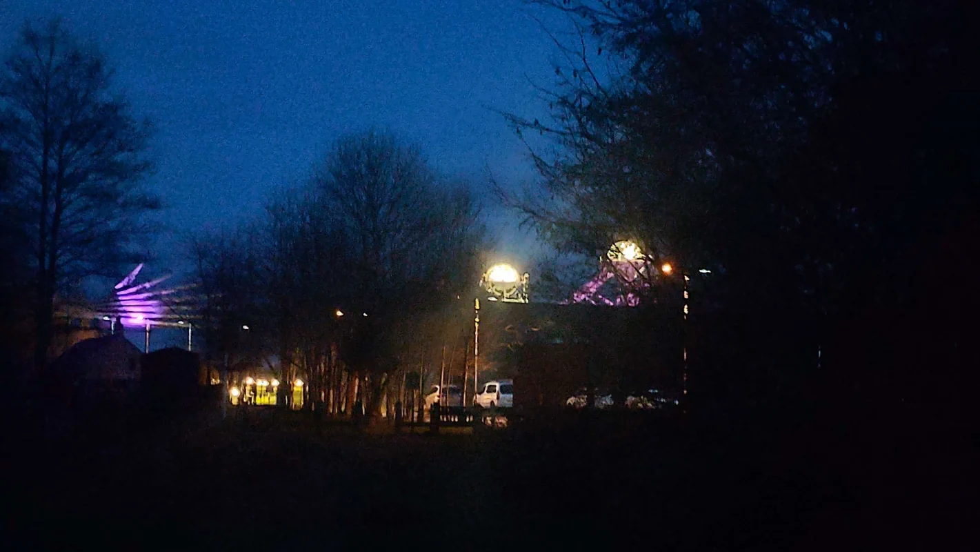
Ashington1 is a poor erstwhile mining town at the very tip-top of the local conurbation, Newcastle’s last gasp before coal and collieries give way to princes and pastures. It takes pride in two things: one, its mining history, and two, the fact that two Ashingtonians delivered England the world cup in a final remembered by ever fewer people.
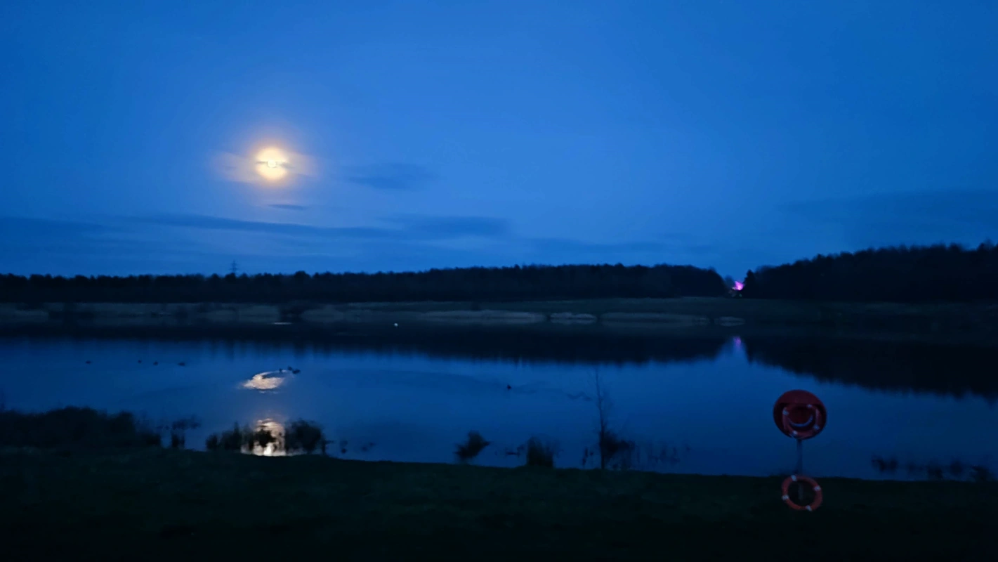
This is the Queen Elizabeth II Country Park — not to be confused with the Queen Elizabeth II Olympic Park down in that London — a marvellous regeneration project which has turned a spoil heap into a lovely lake complete with a Premier Inn. That purple light off in the distance is the Woodhorn Colliery Museum, a whistle-stop tour of Northumberland’s mining history which apparently fancies itself the Blackpool of the North.2
And that’s all i wrote. Tune in next time for either another bashed-together filler postcard (by Gods, am i going to have to make Blyth sound appealing next?), or the first annual Horny Awards™. We’ll see how far the Procrastination Monster lets me progress. :-)
I’ve been terribly bored recently, and have been occupying myself by trying out a way i came up with of mapping out elections — a compromise of sorts between geographic maps (which don’t always show the whole picture) and cartograms (which tend to be butt-ugly).
I chose to map out 2019’s results in the North East to get a feel of things:

New Zealand is relatively small, so i figured it would be the best choice for the first full country:

And, finally, the most recent council election in good old Northumberland1:

Hello again. It’s been a while, hasn’t it? I went on a nice riverside walk and thought i’d send you some photos. (Look, i was getting desperate and it was either this or a post about why seven is my favourite number.)
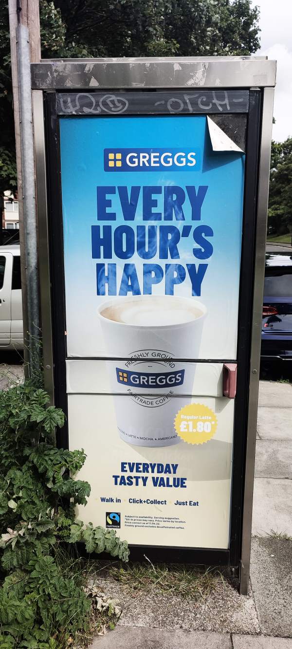
Our scene today is the southern end of Bedlington, a reasonably sized and — if i’m to be honest — terribly mediocre town right in the middle of that conurbation in the southeast of Northumberland. Thankfully, we’re not going to concern ourselves with the town centre (a place whose selling points are a Greggs and a void that used to be a Tesco) — no, we’re going down a steep and heavy slope until we wind up on the steep banks of the river Blyth, where the local parish have kindly set up a path. Won’t you join me?
Seeing this, i was simply overcome by the androgynous urge to stomp and plod around in a stream. (It’s what Hermaphroditos would have wanted.) Alas, my shoes were terribly unfit for such activity, and i had to call it off for another day. A national tragedy!
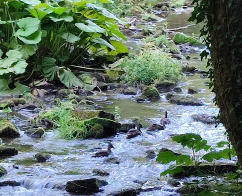
About halfway down the river, there’s this small leafy island that some ducks appear to have claimed as their home. I would have admired it further, but i was being shadowed by by a couple with some particularly yappy and aggressive dogs and really just wanted to get the whole predicament over with.
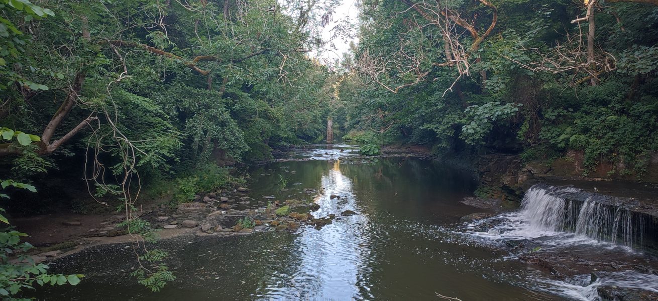
I’m not 100% sure what’s going on with the pillar in the middle — it’s about where the path on the opposite side comes to a sudden stop; perhaps it used to be the support for some kind of railway bridge.
I did, i admit, have to trespass on a dam for this view — the ducks, i hope, would never be grasses. It’s just not in their DNA.
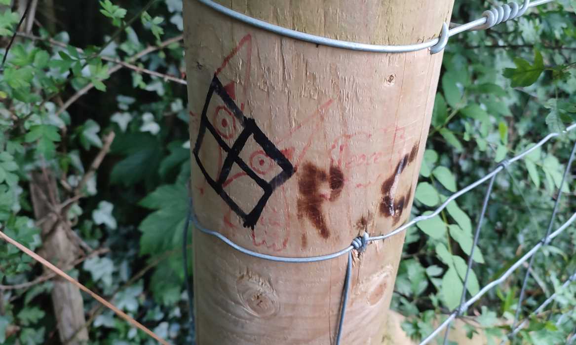
Some incredible visual storytelling here. Someone’s drawn an owl saying “Peace!”, then someone else has come and vandalised it with a swastika, then someone else went and turned the swastika into something resembling the Windows logo. I don’t know where “R.C.” comes into this, but if they were the last fellow, i salute them. Truly, one of the heroes of our time.
(I was somewhat tempted to scribble over it myself and turn it into Loss.jpg…)
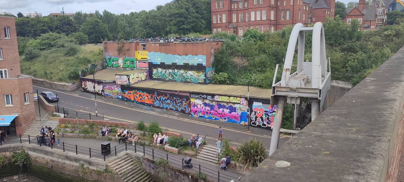
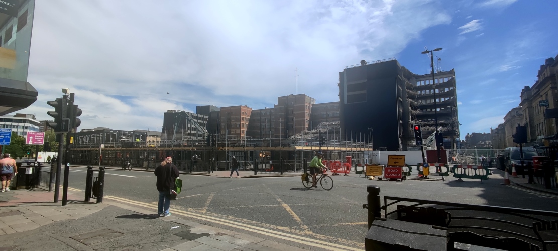
It’s the end of an era in Newcastle, however short it was, as the temporary shipping container food court–cum–public square–cum–shopping centre Stack comes down after three years. The former site of an Odeon cinema was set to be turned into a mixed-use development, but the pandemic caused a change of direction from the developers. The plans have since been slimmed down to just comprise what lockdown proved was truly, 100% necessary:
Offices.
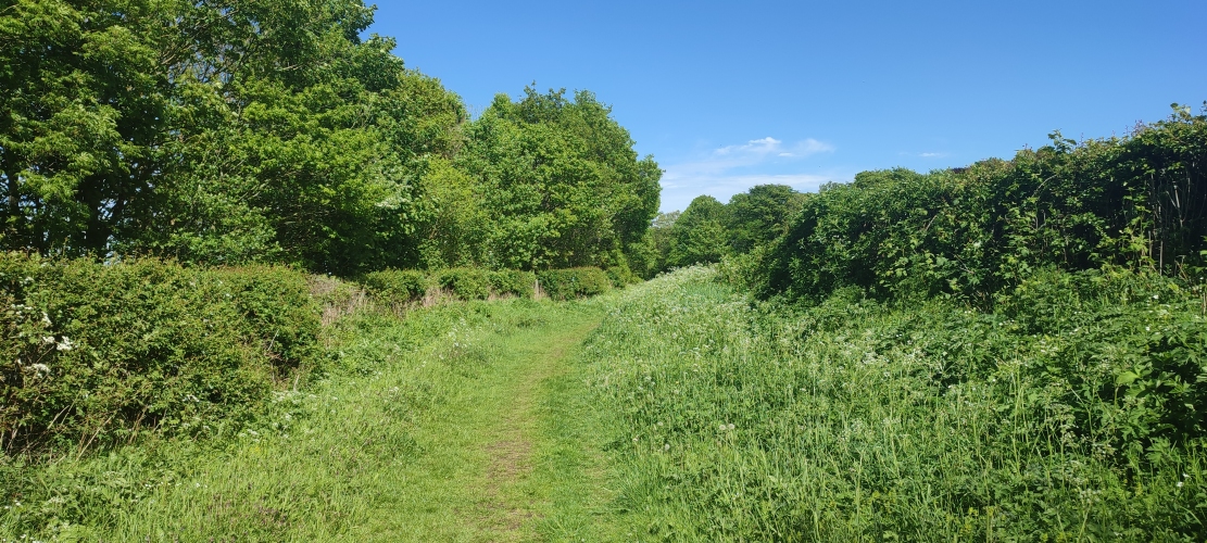
You’d never guess it, but this luscious green path (carefully cropped so that you don’t see the yawning gravel service road behind the camera) is on the former site of a colliery in Bedlington. There’s not much left to see — the neighbouring pit town was bulldozed in the ’70s, and the farmers have done a bang-up job of hiding any traces of the mines that lie underneath.
After 2.3 million pounds and a skyscraper’s worth of scaffolding, Morpeth’s central station has finally been restored to its former Georgian glory, red fences and all. The locals will be pleased to know that Lumo, a sparkly new Ryanair-ified third-class train service from Edinburgh to London, have no choice but to stop here thanks to a sharp bend in the track.
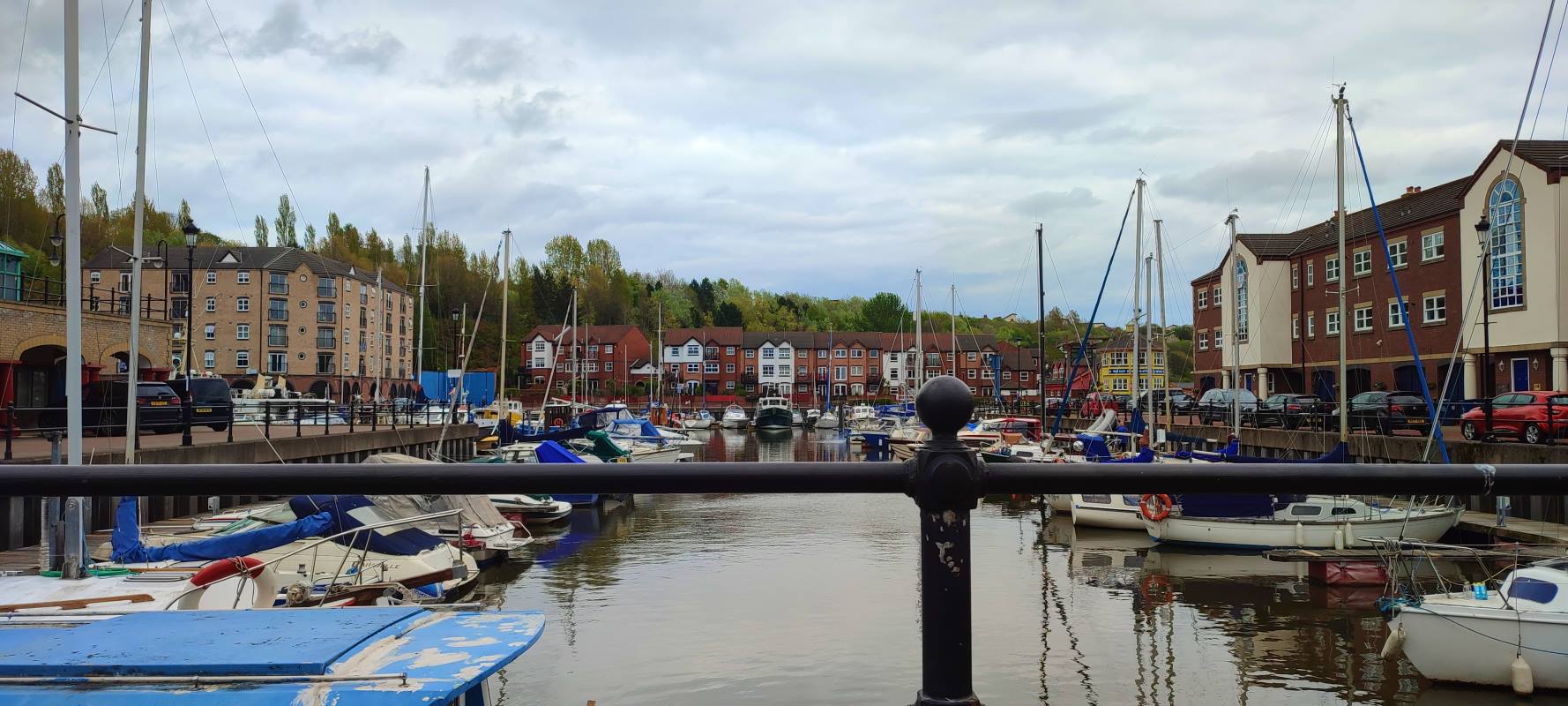
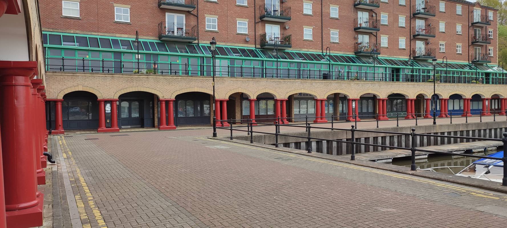
St Peter’s Marina confuses me. It’s like someone dropped a quaint postwar Dutch town centre in the middle of a grimy industrial waste, The river still stinks, and the architecture is — generally — an unconvincing pastiche. Just who is living here?

I had some time to kill after buying my mam a present from Tynemouth’s station market and decided to spend it by taking a walk in the golden hours of the day, now that spring is coming around and the weather isn’t quite so permanently miserable. I thought i might show you some photos.
I went to see everyone’s favourite synth-pop act Chvrches a few nights back, and i must say they put on a hell of a show. Even at the City Hall — quite a stuffy venue by most standards — the crowd went absolutely mental for “Clearest Blue” at the end! (I barely know what came over me.)
Great staging, too — i counted three costume changes throughout the night, including a delectably bloody “FINAL GIRL” shirt for the encore. (Their latest album has a horror-movie gimmick crafted entirely to let them swap remixes1 with John Carpenter — not that i’m complaining.)
The opening act were an Ozzie band called HighSchool who, being brutally honest, should go back to PrimarySchool. They’re one of those acts that basically only know how to write one song over and over, and it’s alright at first, but by take number five of the same sludge you’re praying for it to end, you know? (See also the inexplicably successful 1975 cover band Pale Waves.)
9/10, would stand in line for several hours again.
I was on my usual city constitutional the other week when i noticed that my favourite bubble tea place1 had shuttered. Hm, that’s odd, i thought. Last time that happened was lockdown. Don’t know why they’d do it again. I assumed they’d be back again swiftly, and went on with my day.
Then the week after i noticed that the entrance to the über-hip shipping-container food court of which it was a part was blocked off. Hm, that’s odd, i thought. Ah, well. It’s probably just construction. These things happen all the time.
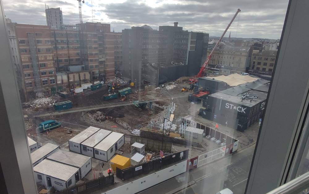
It was only yesterday that i saw the crane lifting one of the shipping containers away and realised something (other than the container) was up. Sure enough, one quick google reveals the flashy new development that’ll be taking its place — originally it was going to be mixed-use, but covid crunch caused them to scale back to the thing that covid really, conclusively proved was absolutely 100% necessary and in demand, definitely: offices.
“Pilgrim’s Quarter” is part of a broader redevelopment of the neglected Pilgrim Street, which may or may not include a pedestrianisation — i don’t know; it’s all in jargonese and i can’t make heads or tails of what Enhancing The Public Realm is meant to mean. (Or, for that matter, why they’ve misspelt it as “Pilgrim’s Quater” on the official brochure.)
The permission slips are all in place — so here’s to you, Stack. You might have had some exorbitant prices (sorry, Korean place, but i’m not paying £12 for a few chicken wings and fries), but otherwyze you were a shining beacon of small businesses in the city centre — you were too good for this world. *Pops open a bottle of champagne*
Down a narrow alleyway to the back end of St Nicholas’ Cathedral, in Newcastle, one can find a rather curious decoration garnishing a door on the opposing façade. The “vampire rabbit” has stood watch over the cathedral for at least half a century; while records are scarce (a quick search of Google Books doesn’t bring up anything until the twenty-first century), it could well date back to the building’s construction in 1901.
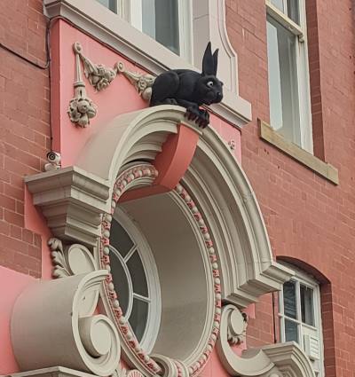
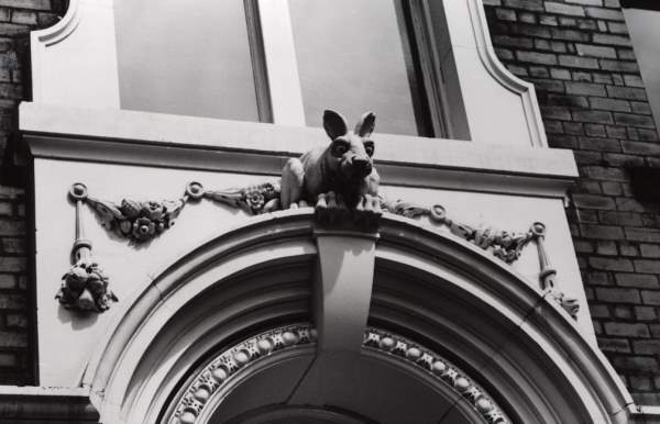
Here’s the thing, though. Nobody knows how it got there. Indeed, even the name “vampire rabbit” is a misnomer; its jet-black fur and red claws were added on some time in the 1990s,i as were its distinctly batty ears. Some say it was put there to scare away wannabe graverobbers, but i have my doubts that twentieth-century crooks would be so dumb.
Yet others posit that it represents a mad March hare, arising at the time of Easter, or that it refers to Thomas Bewick, a nearby engraver who had a fondness of all things lagomorphic. Most fascinatingly, a theory advanced by one Mr Adam Curtis suggests a Masonic pun in reference to one George Hare Phillipson, a local doctor (hence vampires) and active Freemason, as was the lead architect, one William H. Wood. It being a secret society in-joke would also explain why it’s located around the back, rather than the front, which faces onto one of the busiest streets in town.
Perhaps we might never know for sure. In any case, it’s a fascinating little secret — what do you think is most likely?