The GardenDespatches from The Satyrs’ Forest

Posts tagged as “Northumberland”

A despatch from Ashington

I’ve been hammering away at a big ol’ 2022 recap post, trying to get it ready before it’s irrelevant. It seemed cruel to leave you all with nowt over the new year, though, so i thought i might send you some photos from a recent evening walk.

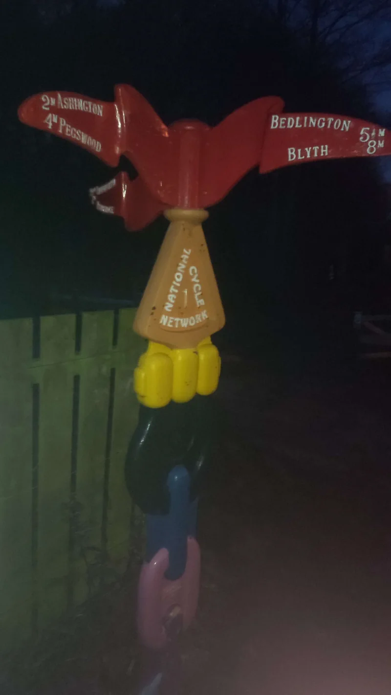
A quixotic signpost for the National Cycle network, done up in rainbow colours and pointing towards destinations in elaborately decorated lettering

Ashington1 is a poor erstwhile mining town at the very tip-top of the local conurbation, Newcastle’s last gasp before coal and collieries give way to princes and pastures. It takes pride in two things: one, its mining history, and two, the fact that two Ashingtonians delivered England the world cup in a final remembered by ever fewer people.

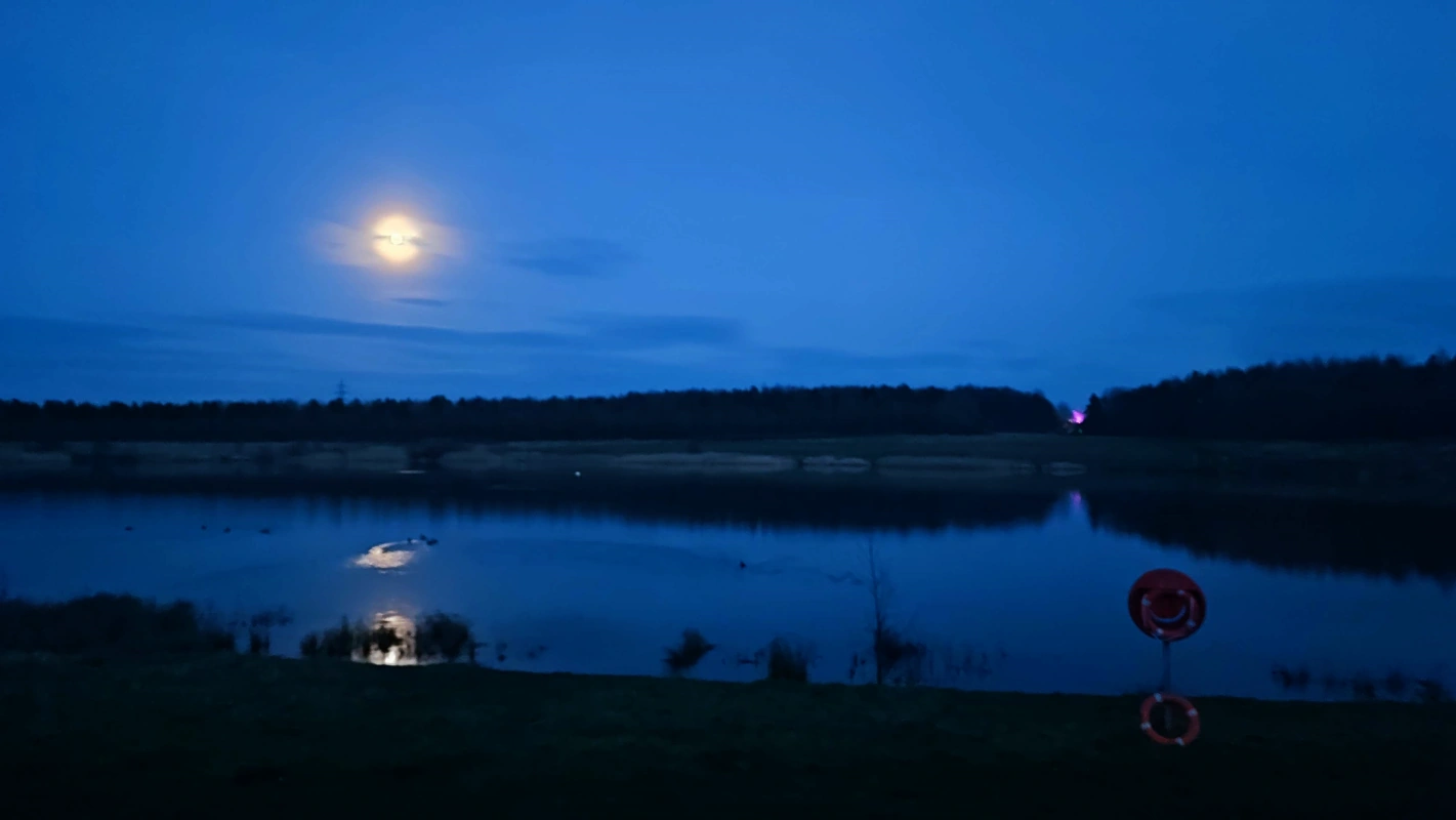
The moon glistens over a large pond in the evening sky; to the right, there's a lifebelt in the foreground and a strange purplish pinprick of light in the background

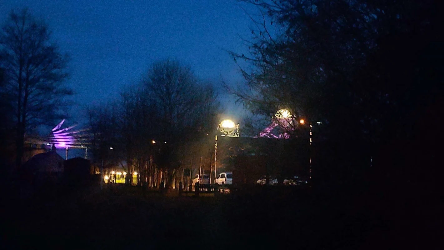
This is the Queen Elizabeth II Country Park — not to be confused with the Queen Elizabeth II Olympic Park down in that London — a marvellous regeneration project which has turned a spoil heap into a lovely lake complete with a Premier Inn. That purple light off in the distance is the Woodhorn Colliery Museum, a whistle-stop tour of Northumberland’s mining history which apparently fancies itself the Blackpool of the North.2

A closer look at the museum reveals that a cutter-like building is lit up in purple, while two old mining rigs have their spokes illuminated as if they were neon

And that’s all i wrote. Tune in next time for either another bashed-together filler postcard (by Gods, am i going to have to make Blyth sound appealing next?), or the first annual Horny Awards™. We’ll see how far the Procrastination Monster lets me progress. :‌-)

Some election maps

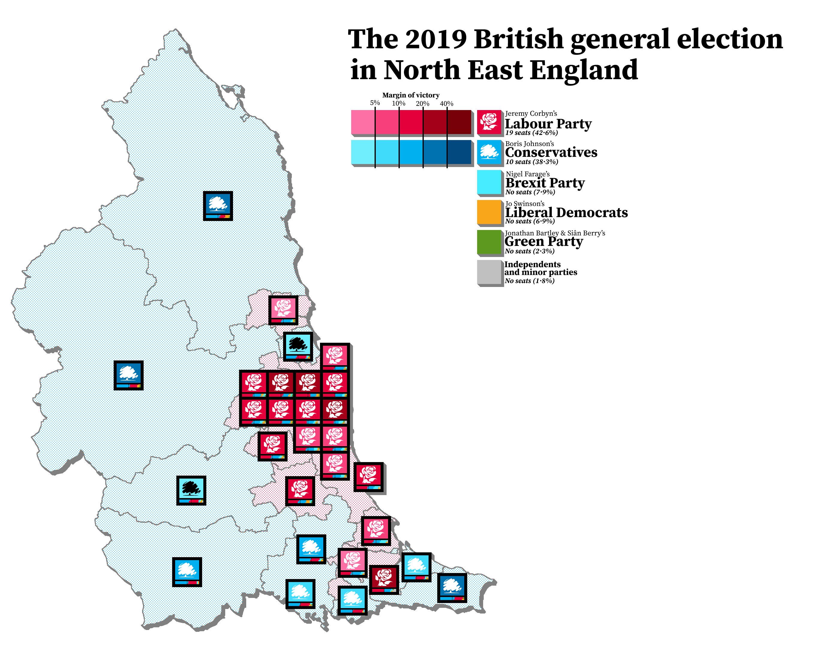
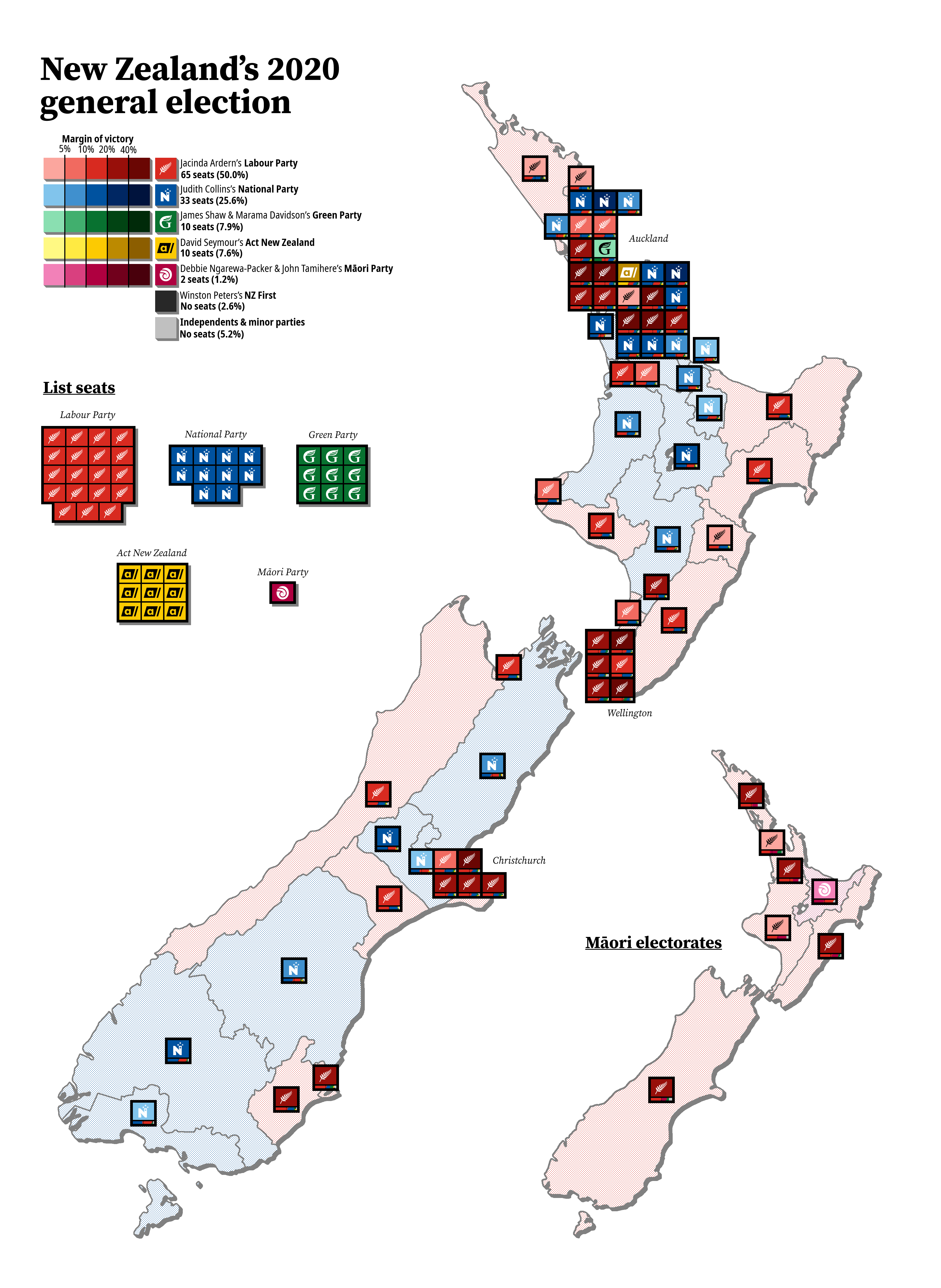
I’ve been terribly bored recently, and have been occupying myself by trying out a way i came up with of mapping out elections — a compromise of sorts between geographic maps (which don’t always show the whole picture) and cartograms (which tend to be butt-ugly).

I chose to map out 2019’s results in the North East to get a feel of things:

A map showing the most recent general election as it was in North East England, with Labour winning a majority of seats

New Zealand is relatively small, so i figured it would be the best choice for the first full country:

And, finally, the most recent council election in good old Northumberland1:

A map showing the results of an election in Northumberland, with the Conservatives winning

A walk down Bedlington Country Park

Hello again. It’s been a while, hasn’t it? I went on a nice riverside walk and thought i’d send you some photos. (Look, i was getting desperate and it was either this or a post about why seven is my favourite number.)

Our scene today is the southern end of Bedlington, a reasonably sized and — if i’m to be honest — terribly mediocre town right in the middle of that conurbation in the southeast of Northumberland. Thankfully, we’re not going to concern ourselves with the town centre (a place whose selling points are a Greggs and a void that used to be a Tesco) — no, we’re going down a steep and heavy slope until we wind up on the steep banks of the river Blyth, where the local parish have kindly set up a path. Won’t you join me?


Seeing this, i was simply overcome by the androgynous urge to stomp and plod around in a stream. (It’s what Hermaphroditos would have wanted.) Alas, my shoes were terribly unfit for such activity, and i had to call it off for another day. A national tragedy!


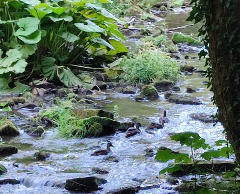
Four or so ducks swim peacefully down a rocky stream, flanked on their left by a small islet overshadowed by leaves.

About halfway down the river, there’s this small leafy island that some ducks appear to have claimed as their home. I would have admired it further, but i was being shadowed by by a couple with some particularly yappy and aggressive dogs and really just wanted to get the whole predicament over with.


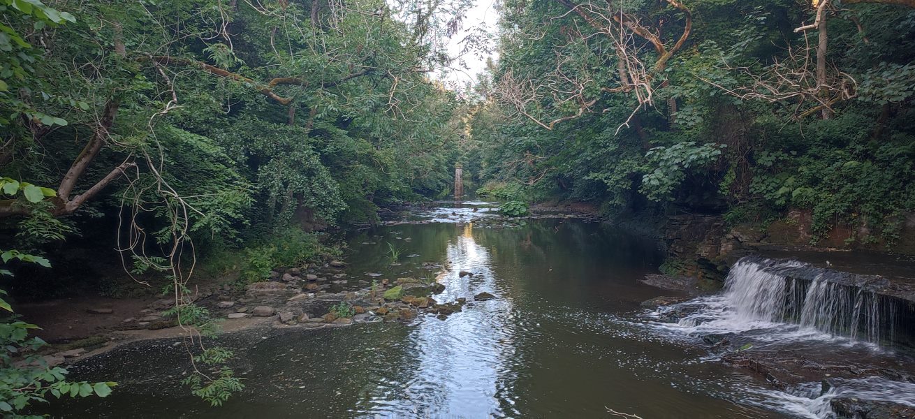
A view from the middle of a river — water pours down a dam on the right, while in the dead centre, a pillar is visible in the distance.

I’m not 100% sure what’s going on with the pillar in the middle — it’s about where the path on the opposite side comes to a sudden stop; perhaps it used to be the support for some kind of railway bridge.

I did, i admit, have to trespass on a dam for this view — the ducks, i hope, would never be grasses. It’s just not in their DNA.


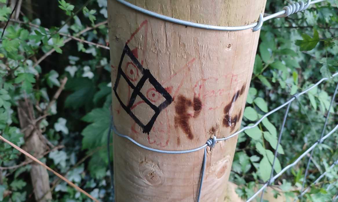
A fencepost crudely vandalised with some sort of four-way grid, an owl saying “Peace”, and the burnt-in initials of one “R.C.”

Some incredible visual storytelling here. Someone’s drawn an owl saying “Peace!”, then someone else has come and vandalised it with a swastika, then someone else went and turned the swastika into something resembling the Windows logo. I don’t know where “R.C.” comes into this, but if they were the last fellow, i salute them. Truly, one of the heroes of our time.

(I was somewhat tempted to scribble over it myself and turn it into Loss.jpg…)

A walk down to the Quayside

https://www.youtube.com/watch?v=w1eN8vyVFIM
This article comes equipped with its own optional soundtrack for those who want to follow along with my listening habits as well as my walk.
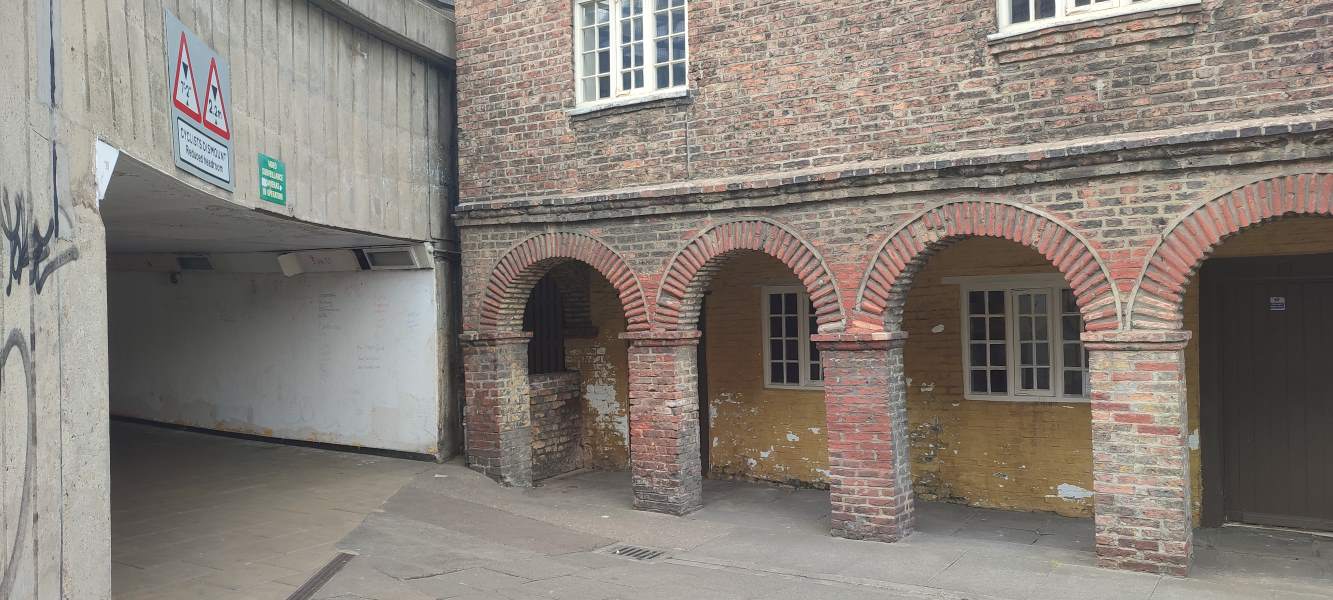
A decaying building’s brick-arched frontage contrasts with a concrete underpass.
We begin at the Holy Jesus Hospital, whose site served as an almshouse for the poor for seven hundred years.
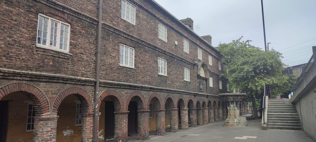
More brick arches, trailing off into the background.
The current 17th-century building now serves as office space for the National Trust. No noseys allowed (shame!)
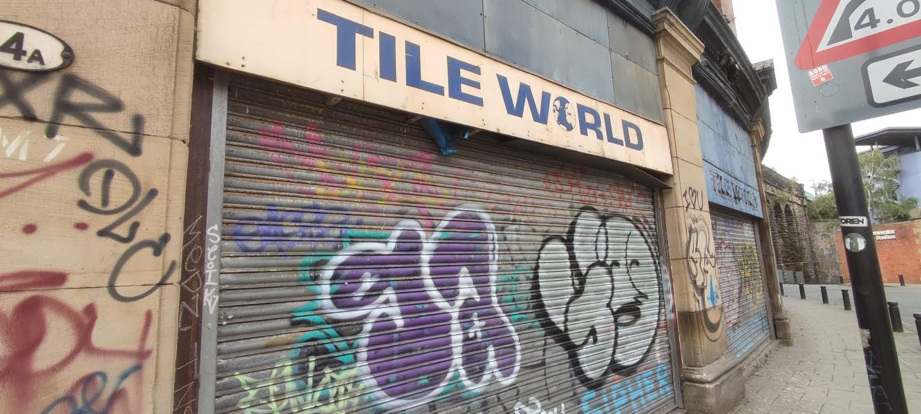
The frontage of a shop by the name of “Tile World” (with a globe replacing the O), its shutters now covered with graffiti.
Anyone need some tiles?
I’m pretty sure this is either “Hallelujah” or “Jerusalem”, but i have absolutely no idea which.
https://www.youtube.com/watch?v=FQlAEiCb8m0
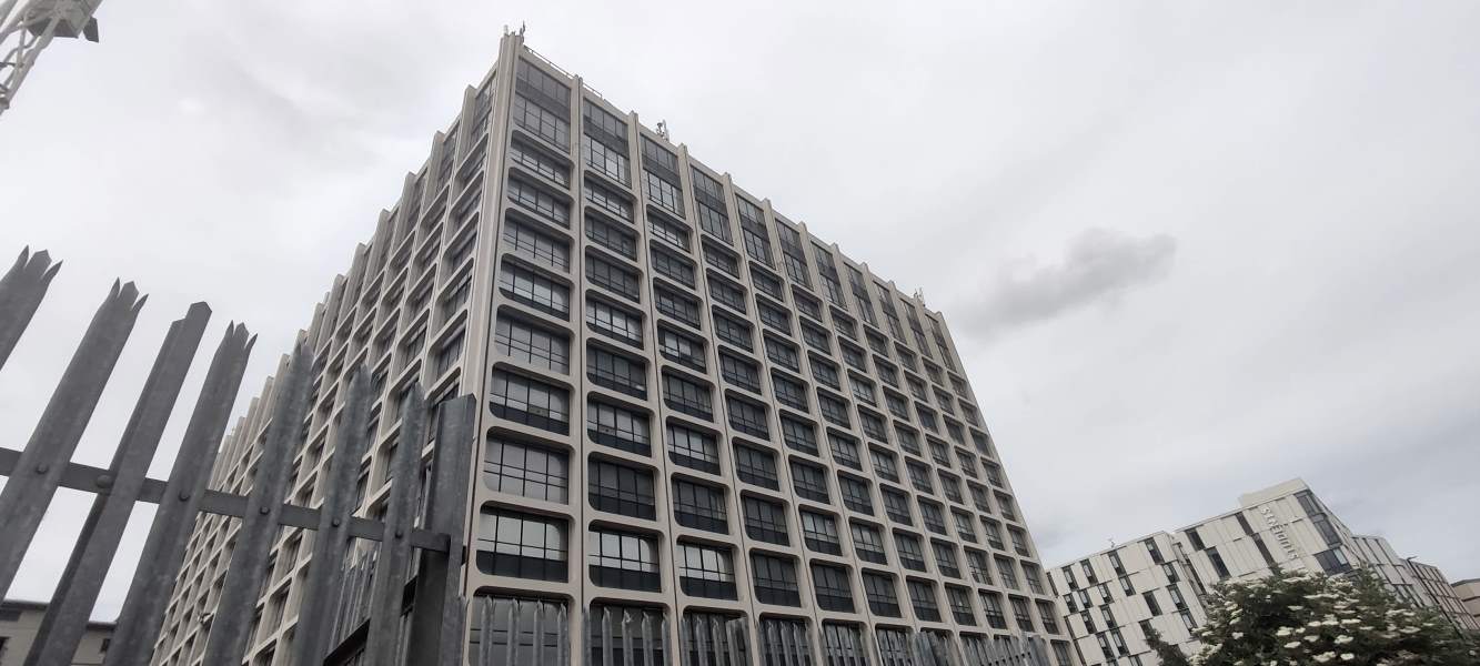
A hulking grey concrete building scrapes the sky.
Only a scant few BT-branded trucks occupy the parking lot of this hulking concrete husk, surely far too big for its intended purpose.
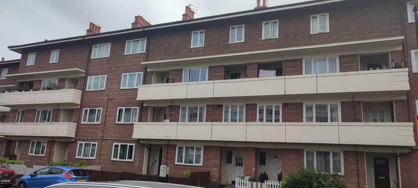
Four floors of brick flats.
Ahhh — reminds me of home, back in Hoorn.
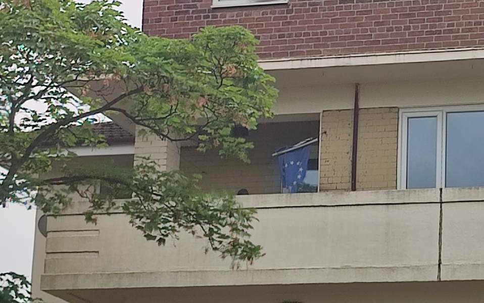
A worn European Union flag hangs over a balcony.
The tragedy of Brexit.
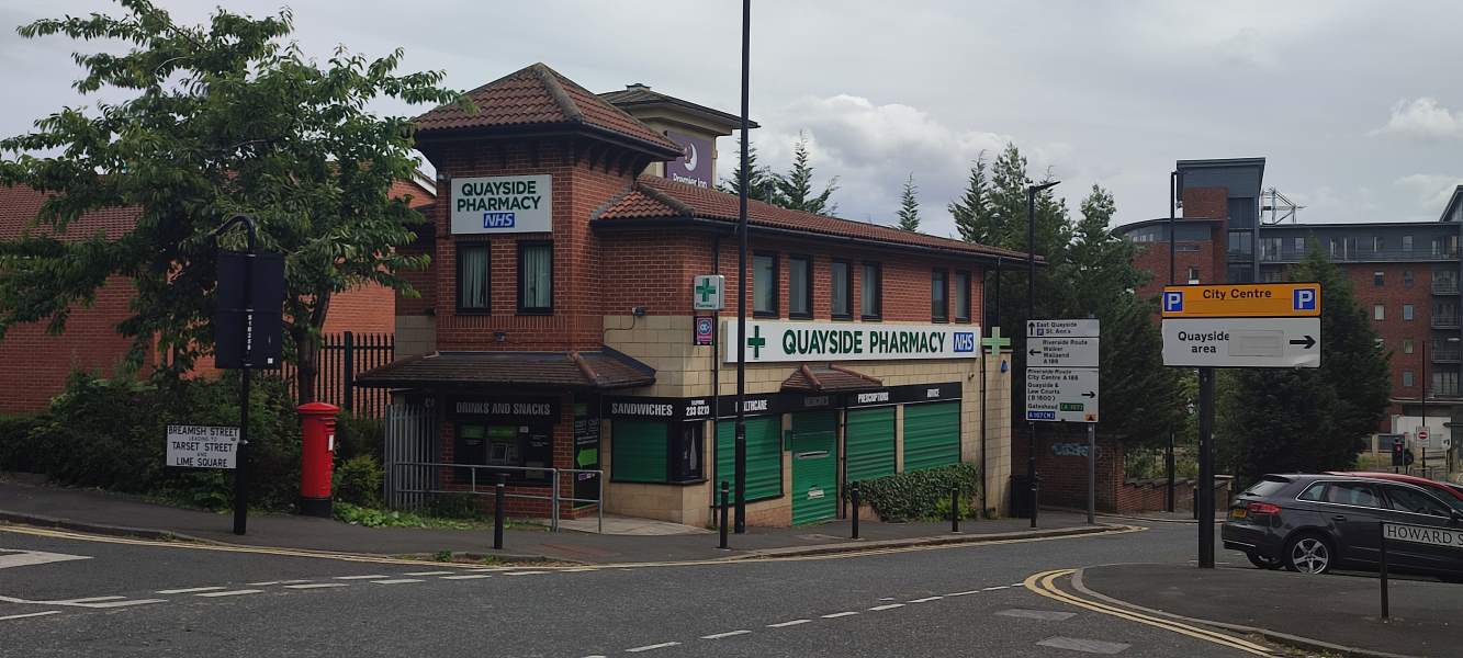
Quayside Pharmacy
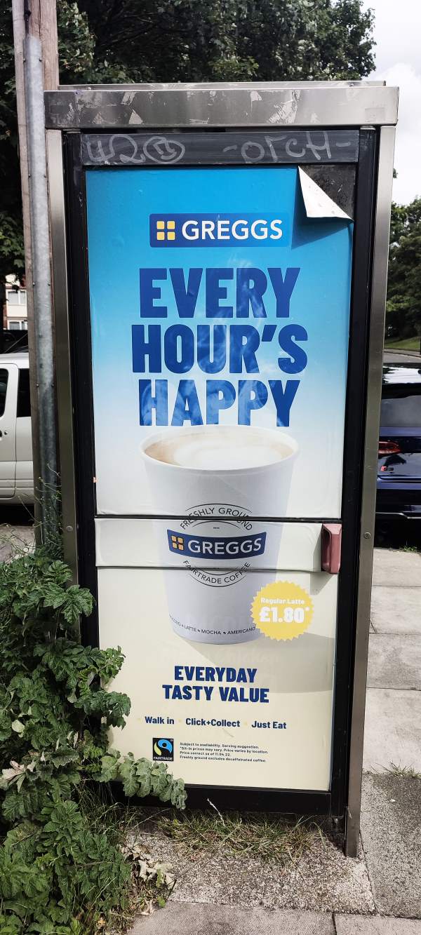
An advert for Greggs’ all-day coffee, reading “Every Hour’s Happy”.
Is it, Greggs? Is it?
https://www.youtube.com/watch?v=1hHSH9sJUEo
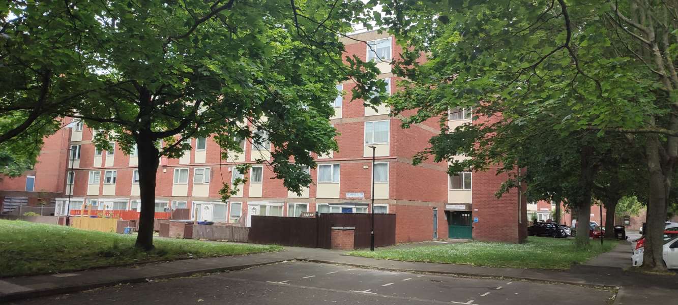
Leafy trees and paths cover another brick flat.
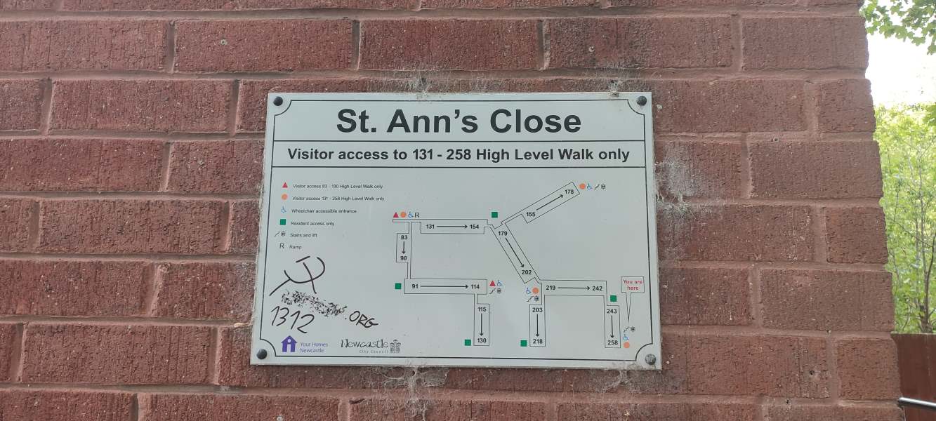
A diagram of the flat of St Ann’s Close has been vandalised with a hammer and sickle, a blurred-out website link, and “1312”.
There’s a lot of commie graffiti scattered along this road, though all of it seems to be by the same person — you can tell because they can’t draw a hammer and sickle.
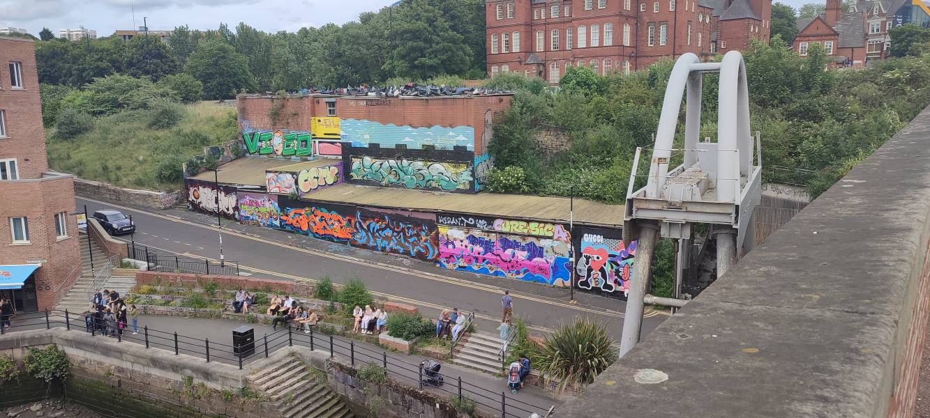
Walls upon walls absolutely covered with artisan graffiti.
Bloody showoffs. (That reminds me — i have a massive unpublished gallery post of a walk down the full length of the Ouseburn, but never did get around to finishing it… maybe soon?)
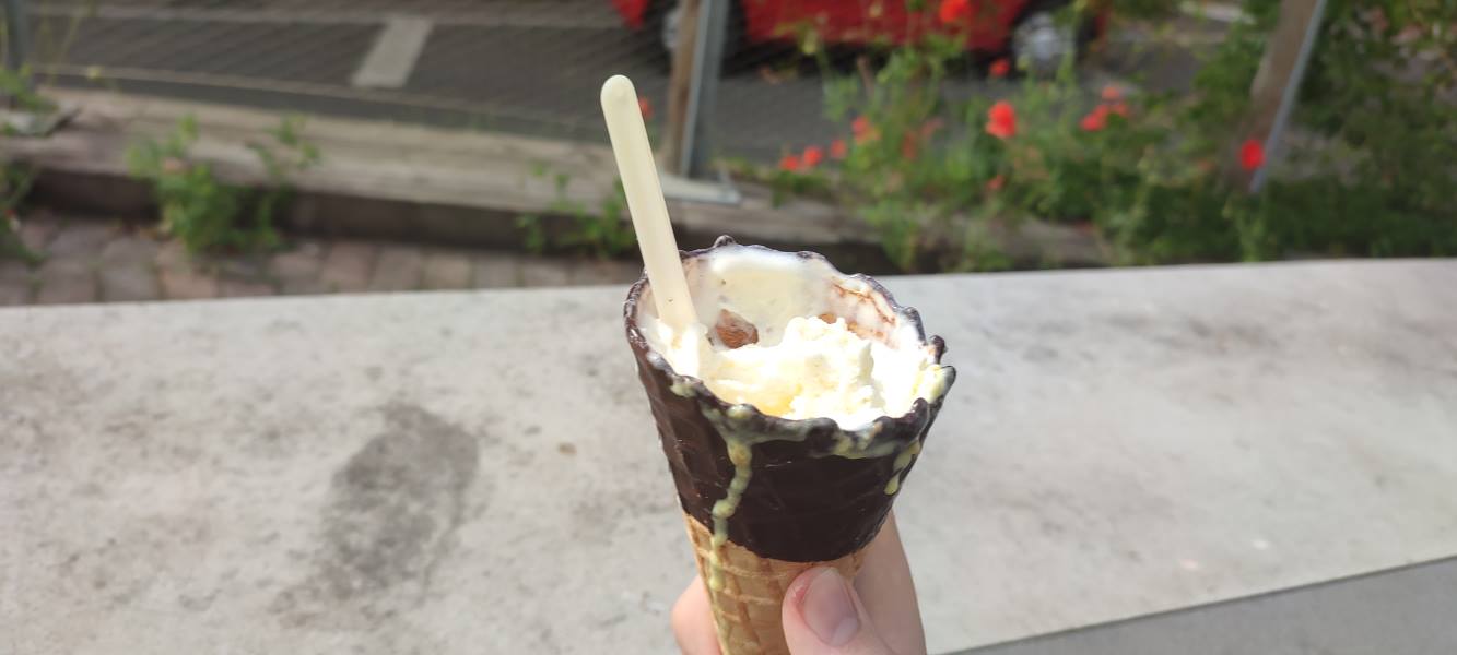
Your author’s hand holds a nice ice cream.
The most important meal of the day.1
A ticket to see “Top Gun: Maverick” at the Tyneside Cinema.
I’ve decided to join the Sea Org and give my life’s savings to the military-industrial complex. (In all seriousness, it was a bloody brilliant film — everything a blockbuster should be!)

Photos from around Lower Northumberland

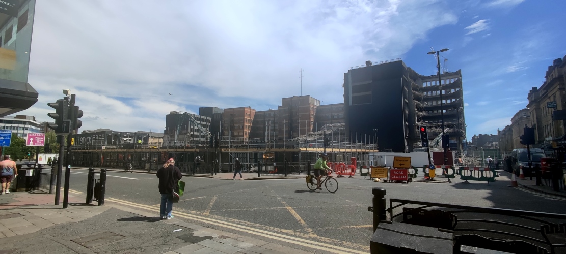
A building demolition in progress around a busy intersection.

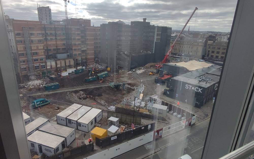
It’s the end of an era in Newcastle, however short it was, as the temporary shipping container food court–cum–public square–cum–shopping centre Stack comes down after three years. The former site of an Odeon cinema was set to be turned into a mixed-use development, but the pandemic caused a change of direction from the developers. The plans have since been slimmed down to just comprise what lockdown proved was truly, 100% necessary:

Offices.

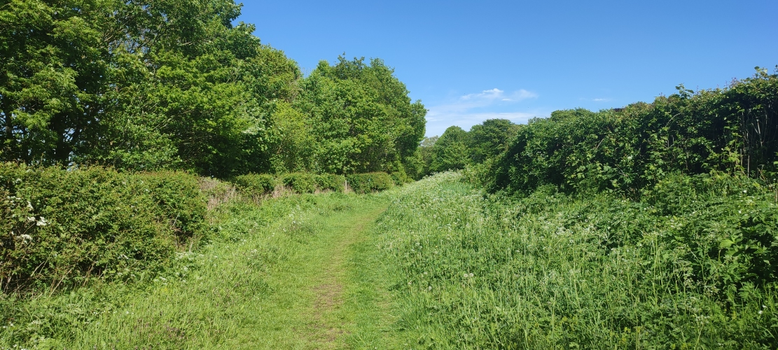
A grassy path surrounded by bright green bushes and trees and a clear cerulean sky.

You’d never guess it, but this luscious green path (carefully cropped so that you don’t see the yawning gravel service road behind the camera) is on the former site of a colliery in Bedlington. There’s not much left to see — the neighbouring pit town was bulldozed in the ’70s, and the farmers have done a bang-up job of hiding any traces of the mines that lie underneath.

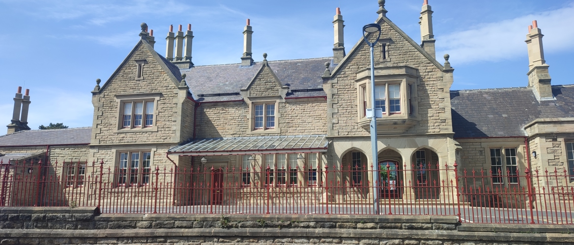
An old-fashioned railway station.

After 2.3 million pounds and a skyscraper’s worth of scaffolding, Morpeth’s central station has finally been restored to its former Georgian glory, red fences and all. The locals will be pleased to know that Lumo, a sparkly new Ryanair-ified third-class train service from Edinburgh to London, have no choice but to stop here thanks to a sharp bend in the track.

Dispatches from a coastal walk

I had some time to kill after buying my mam a present from Tynemouth’s station market and decided to spend it by taking a walk in the golden hours of the day, now that spring is coming around and the weather isn’t quite so permanently miserable. I thought i might show you some photos.

These are not the warm, jade waters of the Mediterranean — the North Sea is (usually) grim, cold, and trying to kill you.
St Mary’s Lighthouse, off the coast between Seaton Sluice and Whitley Bay. Fond memories of many a school trip.
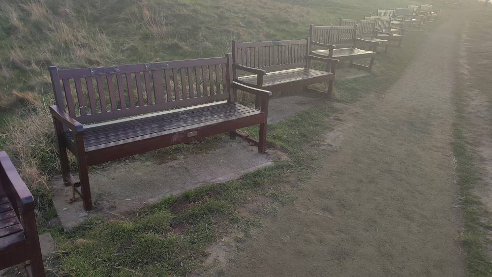
A very long series of public benches
Oh shit i took both pills and now i’m stuck in the Bench Dimension

Chvrches at City Hall

I swear this is fair dealing.

I went to see everyone’s favourite synth-pop act Chvrches a few nights back, and i must say they put on a hell of a show. Even at the City Hall — quite a stuffy venue by most standards — the crowd went absolutely mental for “Clearest Blue” at the end! (I barely know what came over me.)

Great staging, too — i counted three costume changes throughout the night, including a delectably bloody “FINAL GIRL” shirt for the encore. (Their latest album has a horror-movie gimmick crafted entirely to let them swap remixes1 with John Carpenter — not that i’m complaining.)

Now imagine the same distorted whingeing and generic melody for half an hour straight.

The opening act were an Ozzie band called HighSchool who, being brutally honest, should go back to PrimarySchool. They’re one of those acts that basically only know how to write one song over and over, and it’s alright at first, but by take number five of the same sludge you’re praying for it to end, you know? (See also the inexplicably successful 1975 cover band Pale Waves.)

9/10, would stand in line for several hours again.

Eulogy for a food court

I was on my usual city constitutional the other week when i noticed that my favourite bubble tea place1 had shuttered. Hm, that’s odd, i thought. Last time that happened was lockdown. Don’t know why they’d do it again. I assumed they’d be back again swiftly, and went on with my day.

Then the week after i noticed that the entrance to the über-hip shipping-container food court of which it was a part was blocked off. Hm, that’s odd, i thought. Ah, well. It’s probably just construction. These things happen all the time.

It was only yesterday that i saw the crane lifting one of the shipping containers away and realised something (other than the container) was up. Sure enough, one quick google reveals the flashy new development that’ll be taking its place — originally it was going to be mixed-use, but covid crunch caused them to scale back to the thing that covid really, conclusively proved was absolutely 100% necessary and in demand, definitely: offices.

“Pilgrim’s Quarter” is part of a broader redevelopment of the neglected Pilgrim Street, which may or may not include a pedestrianisation — i don’t know; it’s all in jargonese and i can’t make heads or tails of what Enhancing The Public Realm is meant to mean. (Or, for that matter, why they’ve misspelt it as “Pilgrim’s Quater” on the official brochure.)

The permission slips are all in place — so here’s to you, Stack. You might have had some exorbitant prices (sorry, Korean place, but i’m not paying £12 for a few chicken wings and fries), but otherwyze you were a shining beacon of small businesses in the city centre — you were too good for this world. *Pops open a bottle of champagne*
The mystery of Newcastle’s vampire rabbit

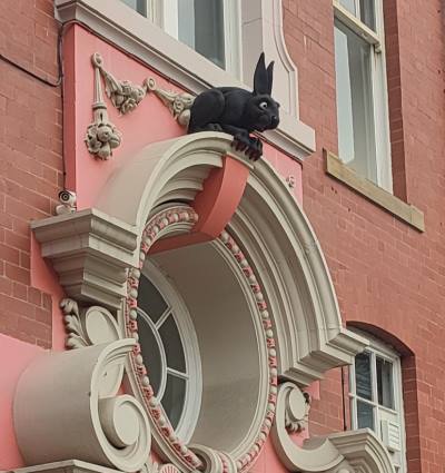
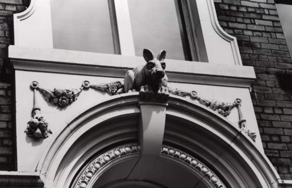
Down a narrow alleyway to the back end of St Nicholas’ Cathedral, in Newcastle, one can find a rather curious decoration garnishing a door on the opposing façade. The “vampire rabbit” has stood watch over the cathedral for at least half a century; while records are scarce (a quick search of Google Books doesn’t bring up anything until the twenty-first century), it could well date back to the building’s construction in 1901.

Spooky.
Here’s a noticeably brighter bun, as it looked in 1987.

Here’s the thing, though. Nobody knows how it got there. Indeed, even the name “vampire rabbit” is a misnomer; its jet-black fur and red claws were added on some time in the 1990s,i as were its distinctly batty ears. Some say it was put there to scare away wannabe graverobbers, but i have my doubts that twentieth-century crooks would be so dumb.

Yet others posit that it represents a mad March hare, arising at the time of Easter, or that it refers to Thomas Bewick, a nearby engraver who had a fondness of all things lagomorphic. Most fascinatingly, a theory advanced by one Mr Adam Curtis suggests a Masonic pun in reference to one George Hare Phillipson, a local doctor (hence vampires) and active Freemason, as was the lead architect, one William H. Wood. It being a secret society in-joke would also explain why it’s located around the back, rather than the front, which faces onto one of the busiest streets in town.

Perhaps we might never know for sure. In any case, it’s a fascinating little secret — what do you think is most likely?

Other people's posts

Some nice local businesses at Ponteland market

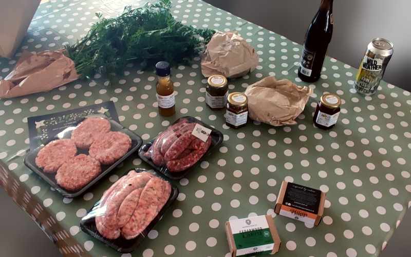
A table filled with alkin goods and crafts

The family and i went to a local food-and-craft market at Ponteland’s garden centre this morning. I thought i’d send letters of recommendation for some of the stalls.

Urban Bakery, from Gateshead, make the most decadent cinnamon buns i’ve ever had.

The Alnwick Soap Company produce wonderful soaps inspired by the scents of rural Northumberland. I plumped for the ginger-and-grapefruit and cedarwood-and-juniper myself.

Mrs B’s Kitchen, from Durham, sells jams, conserves, chutneys, honey, sauces — all the things you ever need in the top drawer of your fridge. (I got the rhubarb and raspberry.)

Hops and Dots, of Bishop Auckland, make “accessible craft beer” with Braille on the labels.

Wilde Farm, of Ponteland, are ostensibly running the whole thing, and sell... you know, farm things. Carrots, veg, burgers, sausages, turkey — you get the idea. They’re currently taking orders for the winter holidays.

Walking the Blyth and Tyne, part two: Oh, Delaval is a terrible place

Last time on The Garden: A strip mall turns out to be a place of immense historical curiosity, i am interrupted by a rude troupe of boy racers, and find myself caught up in the lyrics of a pro-union folk song.

Leaving Seghill, going past a house with a conspicuous Northumbrian flag, the landscape once again slips swiftly back into ruralia — a common occurrence on this leg of the journey. No sooner had i left behind the station house than i found myself on a dirt path which i wasn’t quiiiite sure i was meant to be on.

This was the small hamlet of Mare Close, essentially a farmhouse surrounded by a few cottages. I have a sneaking suspicion that everyone living there has been friends since primary school, though i'll never know for sure. Opposite the cottages, by the next leg of my route, lay a small village church and graveyard which i dared not enter. Onwards.


Seaton Delavalα sits at the heart of the valley. Turning one way, there lies a charming local coöperative store, a genuine lordly manor (owned by the town’s namesake De la Val family, who came over after 1066), the previously-blogged village of Holywell, and, eventually, the seaside settlement of Seaton Sluice.β Unfortunately, we’ll be turning the other way, by where once stood a colliery.

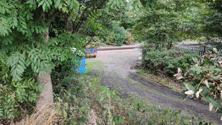
The former site of Delaval’s station can hardly be considered a sight for sore eyes. Cars and lorries pass by, horns blaring, trying to weave their way between those turning into the nearby petrol station.γ The location of the station itself is an uninspiring gravel pit on one site with an overgrown nettle-filled path on the other; next door is a chain pub whose car park will be getting embiggened to accommodate the extra traffic once the railway reopens.

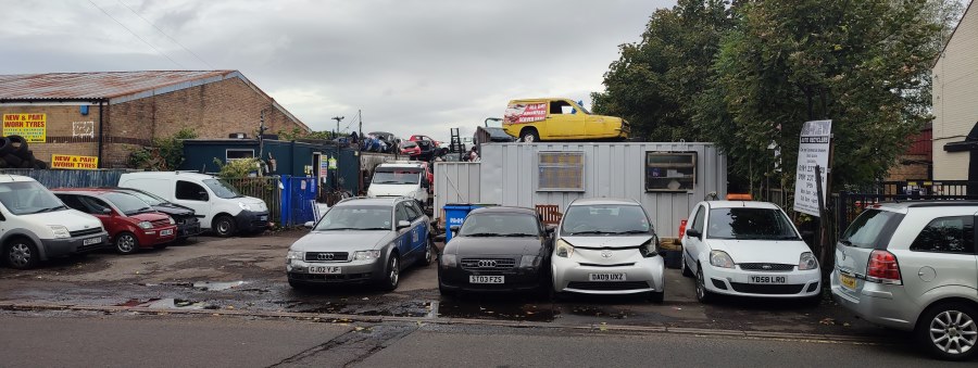
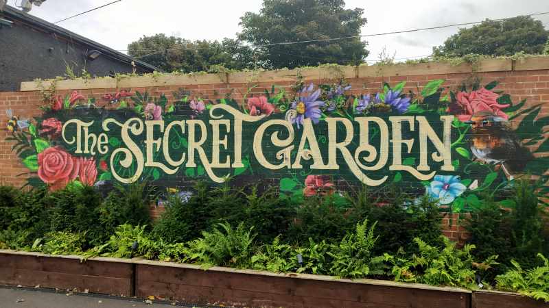
It doesn’t get much better. A few interesting-looking eateries (a grimy-looking café called “Only Fools and Sauces”, a venue by the name of the Secret Gardenδ with a wonderful hand-painted sign) added some initial spice, but soon i was back to the same industrial wasteland: Auto recycling! Furniture wholesalers! Caravan storage! Chemical producers! The works!

...I said something about a colliery, didn’t i?


16 January, 1862. It’s half past ten — or, at least, it might be. You’ve been labouring away in the coal pit since two in the morning, and you’ve not seen the sun since. The shift is almost over, and it’s time to swap over with the next group.

One by one, your comrades file in line to get out. A huddle of people enter the rusting lift. The familiar ketter-ketter-ketter shudders through the cave — but then, for a fraction of a second, all falls silent.

Your heart races. A drop of water falls from the ceiling. Nobody makes a sound.

And then, all of a sudden, it is as though Thor’s hammer has crashed into the ground. The earth around you shakes in terror, lets out what can only be described as an otherworldly scream, as ten tonnes of blood-red steel smash into the floor.


This was the Hartley Pit disaster, and its shockwaves can still be heard across town.

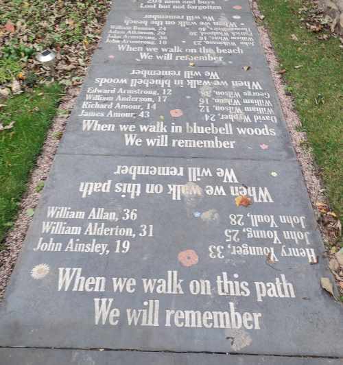
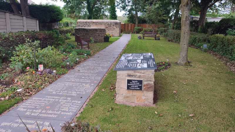
Just across from the telltale jackhammers and yellow tape of a housing estate so new Google Maps hasn’t caught up yetε sits a lovely memorial garden, explaining the story of the tragedy, with a poem to contemplate as you ramble along the path.


In terms of stations, the town has had two — Hartley and Hartley Pit — both right next to each other, and neither seeming to have any chance of reopening.

I was a bit anxious about continuing on, because there were several serious-looking men in hard-hats and high-vis jackets, but they didn’t seem to mind. They really, really should have tried to stop me from going to where i was going next.

Coming up on The Garden: your author tries not to disturb some horses, desperately tries to avoid going to fucking Blyth, and accidentally sneaks in a brief trip to Durham. I promise, it makes sense in context.

Walking the Blyth and Tyne, part one: Northumberland Park to Seghill

Last time on The Garden: the axe falls on the Blyth and Tyne line, and i foolhardily decide to walk its length…

A modern looking metro station divided into two platforms, opening up to the sky above.

Our journey begins at North­um­ber­land Park, in North Tyneside. Though it’s the first station we’ll be visiting, it was the last to be constructed, having only opened in 2005 — and it’s quite easy to tell, even after sixteen years of wear and tear; the place is outfitted with modern amenities, lifts, ticket machines flush with the wall, and, more lately, pandemic-themed graffiti opposite the platform. This unassuming metro station will, according to the county council’s plans, serve as the interchange between the old and new lines, heavy rail and metro meeting one last time before splitting apart and going their separate ways.

A colourful graffito of the word "Pandemik", spelt with a K for reasons unknown.
A modern car park with frosted glass panels juts into the cloudy sky.

Setting off from there, the first thing that caught my eye were twin giants: a frosted glass-covered car park and a red-brick Sainsbury’s, unexpected icons of the modern British condition. It didn’t get much better from there; down the road lies an American-style strip mall lined with bookmakers trying to get people to piss away all their money.

A shopping trolley lies half submerged in a sorry looking scummy stream.
This sorry-looking trolley was, i presume, abandoned from the local Sainsbury’s.

This southernmost tip of North­um­ber­land is criss-crossed by innumerable public footpaths, cycle paths, bridleways, and other routes for non-metal-box-related transport; ducking onto one of the reclaimed “waggonways” once used to transport coal, i found myself on the site of the second station on the list.


Twin rail tracks stretch into the background.

The leafy suburb of Backworth has a habit of burying its history. A hoard of offerings from Roman times was found underground in the 1810s, the last vestiges of the colliery that once was are long gone, and the tale of this sorry ex-station is rather similar. Opened in 1864 to replace a nearby station closing the same day, Back­worth station served its community for over 100 years, surviving the Beeching cuts. But when the Tyne and Wear Metro was announced to come to town, the old station finally closed… for good. It wasn’t until the opening of North­um­ber­land Park that there would be a replacement.

As i wandered through the village's verdant streets, i couldn’t help but think of its resemblance to the straight, cycle-friendly streets of my old hometown. A little greenery can go a long way.


Behind wire fences and train tracks, a van belonging to Network Rail is visible.
A jet-dark pedestrian underpass, its entrance covered in graffiti.
The graffiti reads “Monty Brown is a grass”. I would never say such unkind things about Mr Brown.

Network Rail were hard at work at the site of the aforementioned original Back­worth station, whose plot of land now sits vacant, marking the city’s last hurrah; the further i walked along the dirt back roads, the further the sounds of bustling cars receded, until, ducking under a shady underpass, i found myself utterly alone amongst pastoral fields (and the overwhelming scent of manure).

Hay bales cover a rolling field of wheat.

That peace and quiet was swiftly interrupted by a troupe of boy racers on motorcycles and quad-bikes, but you can’t win them all, you know?


The border between Northumberland and North Tyneside is highlighted in the middle of an unmarked dirt path.
After the county borders were hacked up in 1974, this line became the divider between rural Northumberland and ostensibly-urban Tyne and Wear.

The (post-1974) border town of Seghill occupies only the tiniest fragment of the collective English consciousness, popping up briefly in an anti-scab miners’ folk song called “Blackleg Miner”:

It’s in the evening after dark,
when the blackleg miner creeps to work
With his moleskin pants and dirty shirt
there gans the blackleg miner!

[...]

So, divvint gan near the Seghill mine
Across the way they stretch a line,
to catch the throat and break the spine
of the dirty blackleg miner

[...]

So join the union while you may
Divvint wait till your dying day,
for that may not be far away,
you dirty blackleg miner!

A corner shop by the name of "Station House Stores"

For our purposes, it’s chiefly notable for the fact that it’s the first disused station on the list whose buildings are still intact and in use, this time as a corner shop, from which i of course bought a copy of the local rag — prominently including a Q&A about the restoration of service on the line, which i thought a fitting reminder of why i set out on this silly old journey in the first place.

After getting some well deserved rest, i headed on off towards the next town over, awaiting what fresh stories i would find...


Next time on “Walking the Blyth and Tyne”: your author is reminded of her own mortality, finds himself in the company of a noble family, and shudders at the thought of having to go to Blyth, of all places on Gods’ green Earth

Walking the Blyth and Tyne: an introduction

A montage of scenes around Northumberland, with the caption: "Walking the Blyth and Tyne (a railway odyssey on foot)"
Photo credits: Martin Beek, Reading Tom, bazzadarambler, yellow book

It’s March of 1963. The island of Great Britain is in the throes of its coldest winter in two decades, senior frontbench MP Harold Wilson was recently handed the reins of the Labour party, the Beatles have just released their debut album, and, somewhere in the bowels of Whitehall, Dr Richard Beeching is writing a report that will change the country’s connecting tissue forever.

Dr Beeching, you see, is the chairman of British Railways, the state-owned company in charge of rail transport, and they’re in a spot of financial trouble. British Railways are in charge of running fifteen thousand miles of track shuttling between about four and a half thousand stations, and the only way they can do that is via generous subsidies from Her Majesty’s Government — something which the governing Conservatives, as a rule, are never too happy about.

So, pen in hand, he takes a metaphorical axe to the network, marking about half of the island’s stations for closure. It’s not pleasant, but it has to be done — and, after all, people can just take the car to their nearest station if their town’s is shut.i I’m sure it won’t be too bad.


An old map displaying the former lines of the Blyth and Tyne Railway, along the coast of southern Northumberland

That's how, a year later, the last passenger trains ran along 5,000 miles of railway across England, Scotland, and Wales, including those connecting the mining heartland of industrial Northumberland. The Tyne and Wear Metro, opened in 1980, allowed some of these lines to reopen in Newcastle’s suburbs and (relatively) affluent coastal communities. But just a few miles north, the former Blyth and Tyne Railway has lain dormant ever since the axe fell… until now.

In recent years, the stars have aligned, and both the county council and Westminster have agreed to reopen the line, finally bringing these proud towns back together. The Blyth and Tyne Railway, now rechristened by the more attractive name of the Northumberland Line, is set to reopen by 2024. To celebrate this historic moment, i thought i’d see what has become of the stations and towns that were. I’ve identified fourteen stations, past, present, and future, along the line, and i’ll be walking between each of them in turn, seeing what stories they tell. The list includes:

  • Northumberland Park, the metro station ready and waiting to become the new line’s interchange
  • Backworth (the second)
  • Backworth (the first), already long closed by the time the axe fell
  • Seghill
  • Seaton Delaval, planned for reopening
  • Hartley Pit / Hartley, two old stations just metres apart
  • Newsham, planned for reopening
  • Blyth, on an old branch line
  • Blyth Bebside, planned for reopening
  • Bedlington, planned for reopening
  • North Seaton, now subsumed within Ashington’s town area
  • Ashington, planned for reopening
  • Woodhorn, listed on early plans for reopening but mysteriously disappeared since
  • Newbiggin-by-the-Sea, no longer in existence but with the route there safeguarded just in case

Won’t you join me?